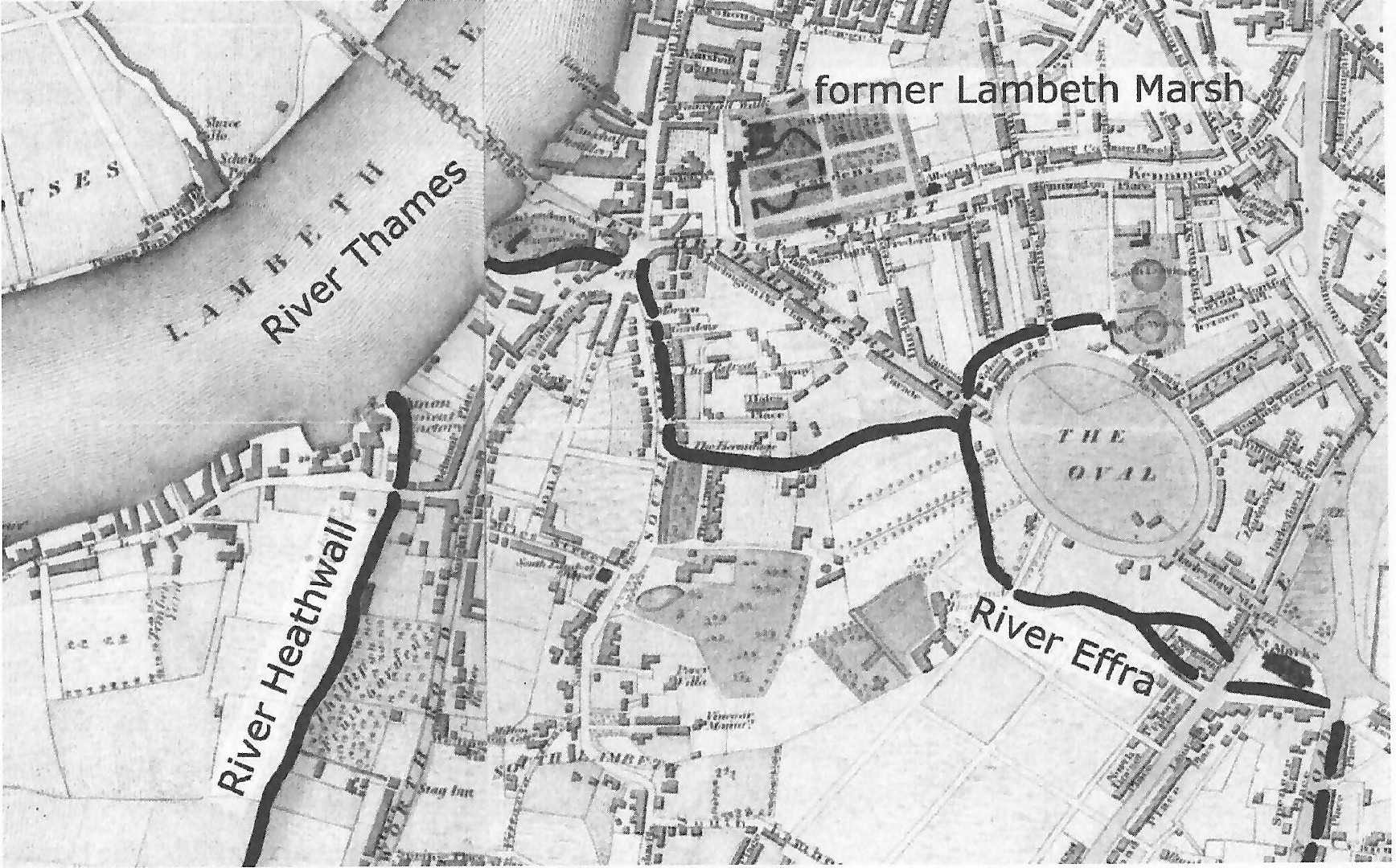
River Effra
The Effra was a river which ran down from Crystal Palace and Sydenham Hill. It originally ran into the Lambeth Marshes to join the Earl's Sluice and run into the Thames at Deptford Wharf, but it was eventually diverted to join the Thames near Vauxhall Bridge.
Most of the river north of Dulwich now forms part of London's combined (surface water and sewage) system so this section of the river no longer exists. But the river still runs underground down to Dulwich and there are two small sections still on the surface.
The Effra's waters north of Dulwich are now drained away east in three intercepting sewers although storm water sometimes reaches the Thames via two outfalls beneath Vauxhall Bridge. (The Effra storm relief sewer shares these with the Heathwall and Duffield storm relief sewers.)
Upper Reaches
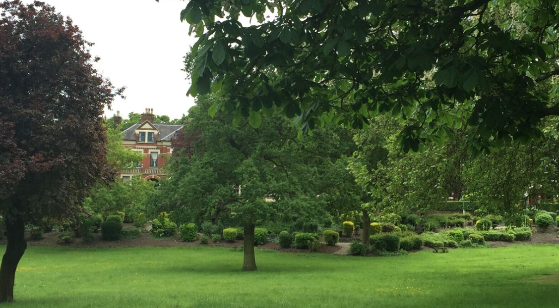
Like most rivers, the Effra had a number of sources, the most important of which was near the top end of what is now Norwood Recreation Ground, off Harold Road just down the hill from Crystal Palace. Here is a photo:
The river then ran, initially through a deep valley,
- via (what is now) the junction of Elder Road and Central Hill,
- then to the east of Elder Road,
- through West Norwood Cemetery,
- and via Croxted Road
- to the junction of several major roads just south of Herne Hill Station.
- The river then ran on along what is now the north-east side of Brockwell Park.
(There is a meandering lake in Belair Park, to the east of Croxted Road, but this appears to have been purely man-made, and not on the course of the Effra.)
Tributaries
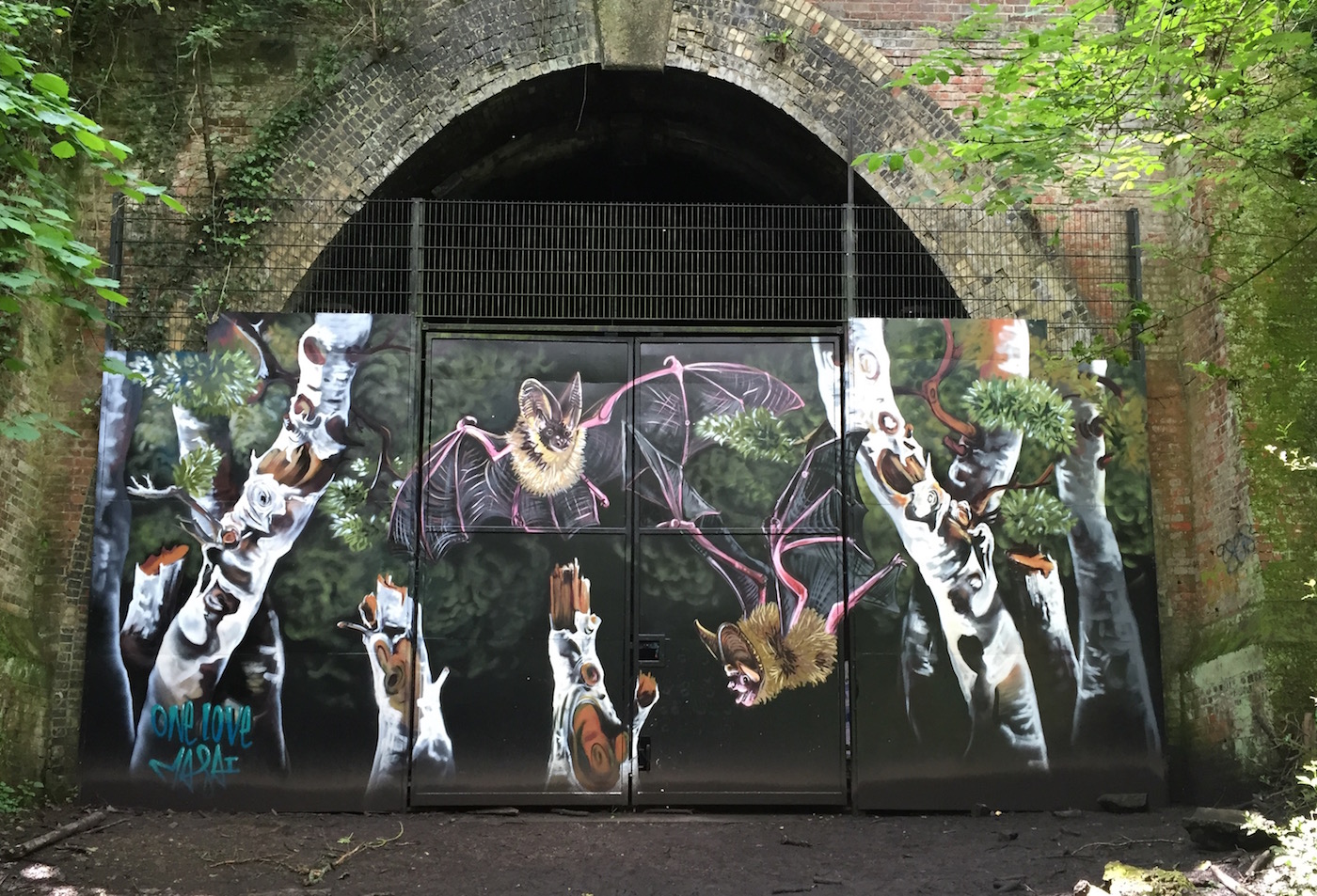
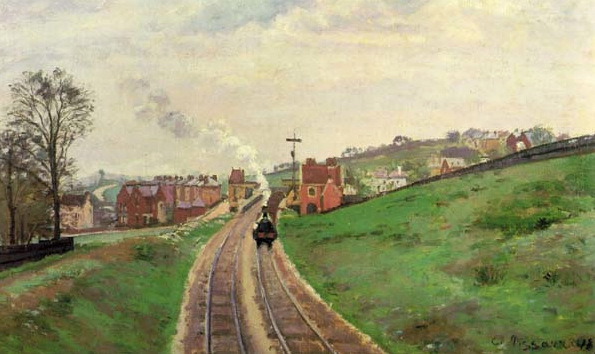
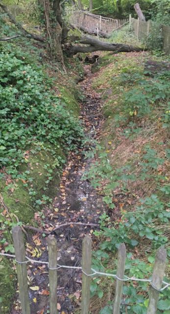
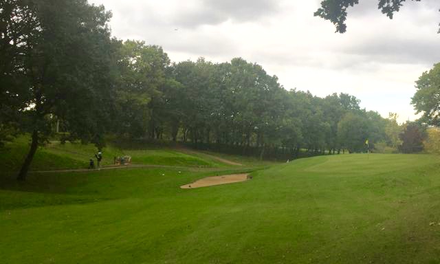
Another important source was the Ambrook in Sydenham Hill Wood (Grid Ref TQ 3436 7257), next to what is now the derelict railway line running up from Nunhead to Crystal Palace (High Level). There is an occasional muddy stream and a small pond (Dewy Pond) between (a) the bat sanctuary in the old railway tunnel - first picture below - and (b) Cox's Bridge, from where Pissarro painted his famous picture of Lordship Lane Station - second picture.
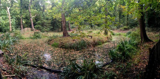
Here are pictures of Dewy Pond and the Ambrook before and after it runs through a distinct valley in the Dulwich and Sydenham Hill Golf Course.
This stream then ran down through Dulwich Park, where this branch of the Effra may still be seen in the form of lakes and a stream, and joined the main river at or before Herne Hill.
Another tributary ran north along the west side of Brockwell Park, joining the Effra near Brixton Water Lane.
Brixton
The now substantial river continued to run north in a shallow valley to the east of what is now Effra Road and then through the centre of Brixton and on along Brixton Road, up towards the Oval. Even today, there is noticeably higher ground to both the east and west of Brixton Road until its junction with Hillyard Street. And the road itself drops around 3.5 metres over the 1000m from Gresham Road to Hillyard Street - hardly precipitous but enough to create a sparkling stream.
The Lower Reaches
 North of Hillyard Street, the ground begins to drop away from Brixton Road, down to the north-east. The Effra ran down this slope into Lambeth Marsh. Click here for a more detailed discussion of the original course of the river.
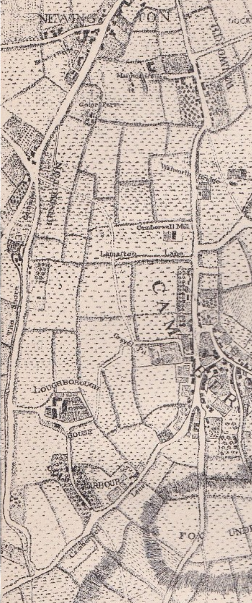
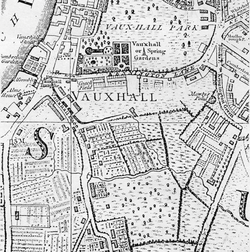
The Diverted River: As London grew, mainly north of the Thames, the Effra was diverted so as to help drain the marsh and so create rich agricultural land to feed London's population. By the 1600s, therefore, the river no longer ran into Lambeth Marsh but instead ran across to Vauxhall. The 1744 map on the left shows the river (then called the Shore) to the west of the Brixton Road though it later ran down the other side. The stretch from Brixton Road to the Thames was known as Vauxhall Creek.
Various sources and old maps confirm that the Effra/Vauxhall Creek eventually ran
- across Cranmer Road, a few metres east of its junction with Brixton Road,
- under Hazards Bridge on the Brixton Road near its junction with Church Row (now Prima Road),
- along Church Row,
- under Clapham Road at Merton Bridge, near its junction with Hanover Place, just south of Oval Station,
- around the south-west side of the Oval itself,
- and then via two branches into the Thames upstream of Vauxhall Bridge. (One of the branches crossed the Wandsworth Road/South Lambeth Road junction at Cox's Bridge.)
The final stretches of the river can be seen in a 1681 map on this web page and on the two maps below dating back to 1790 and 1830 respectively.
Short stretches of the river were navigable, near to the Thames at Vauxhall, but the river was certainly not navigable for any great distance.
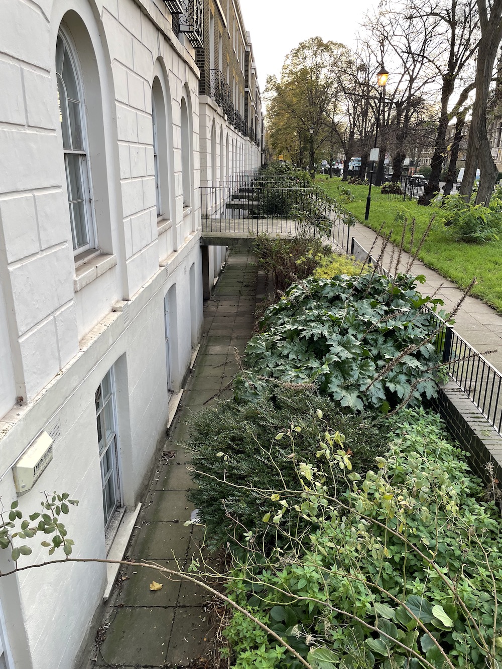
The photograph below shows where the Effra might have run down the eastern side of Brixton Road as it nears the Oval.
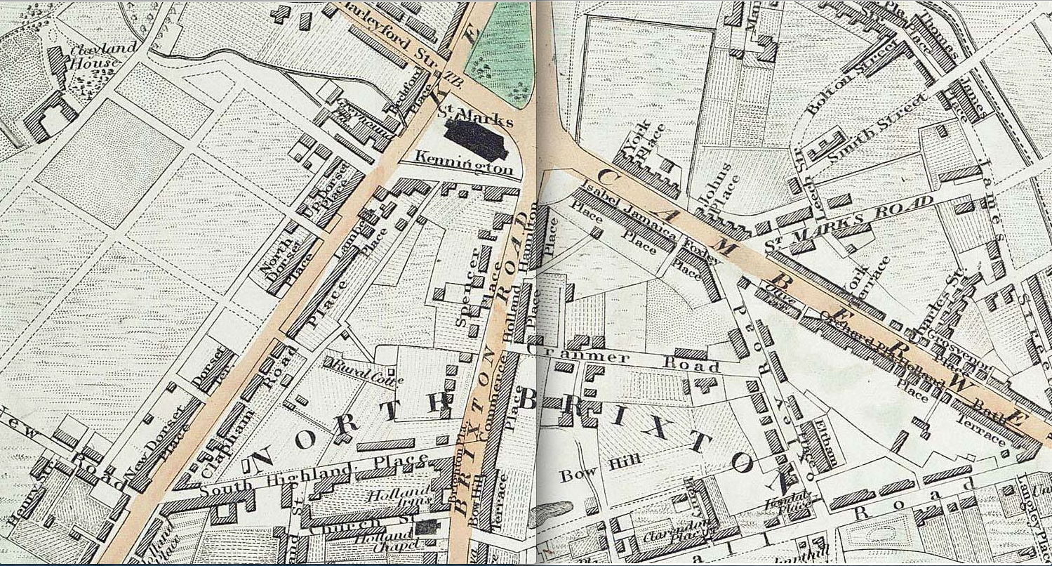
This overmarked C&J Greenwood 1830 map shows the course of the diverted river.
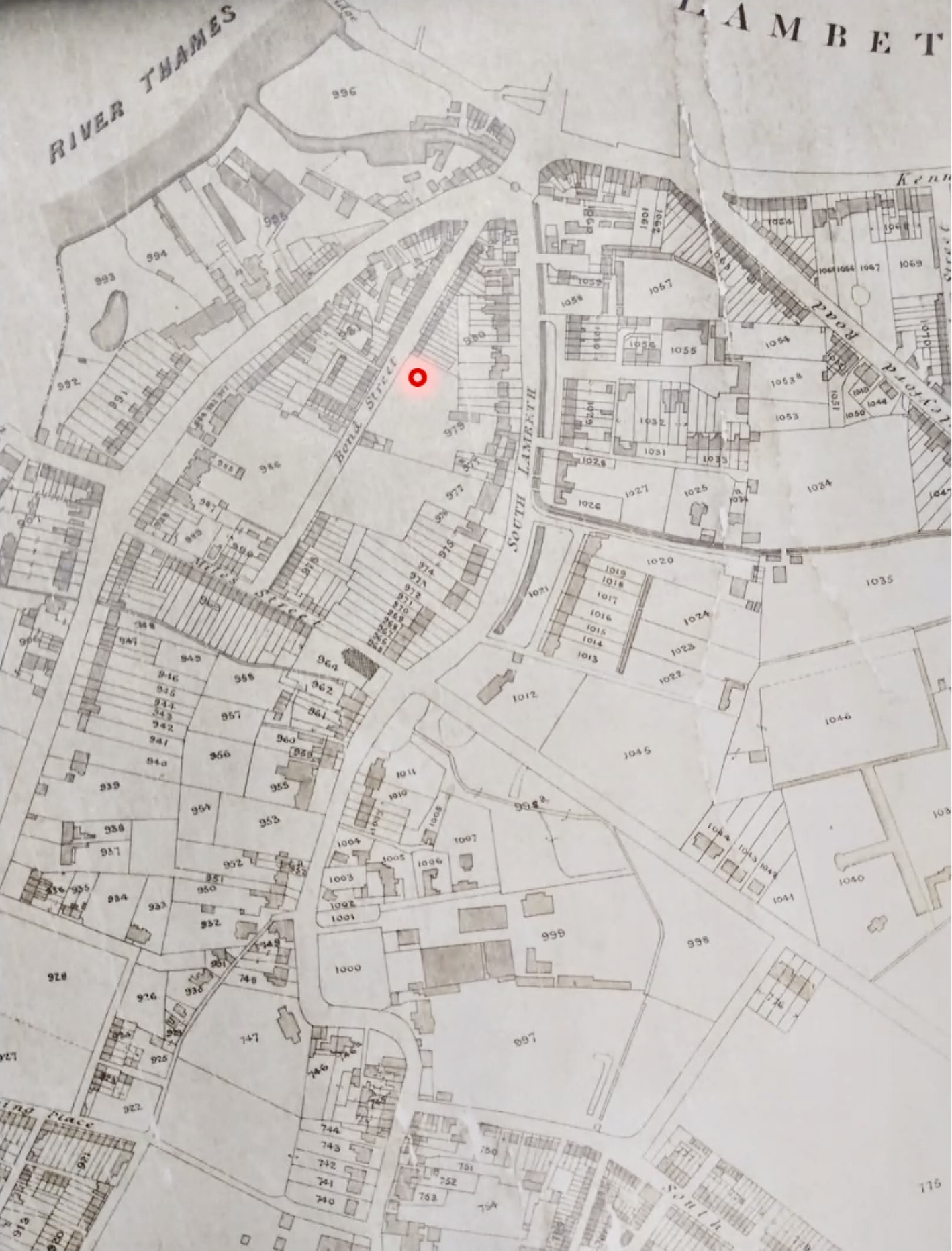
This is an extract from an 1880 map prepared to help organise the final payment of tithes which also shows the course of the Effra near to the Thames. (You can click on this map to bring up a larger image.)
Bazalgette and Vauxhall Sluice
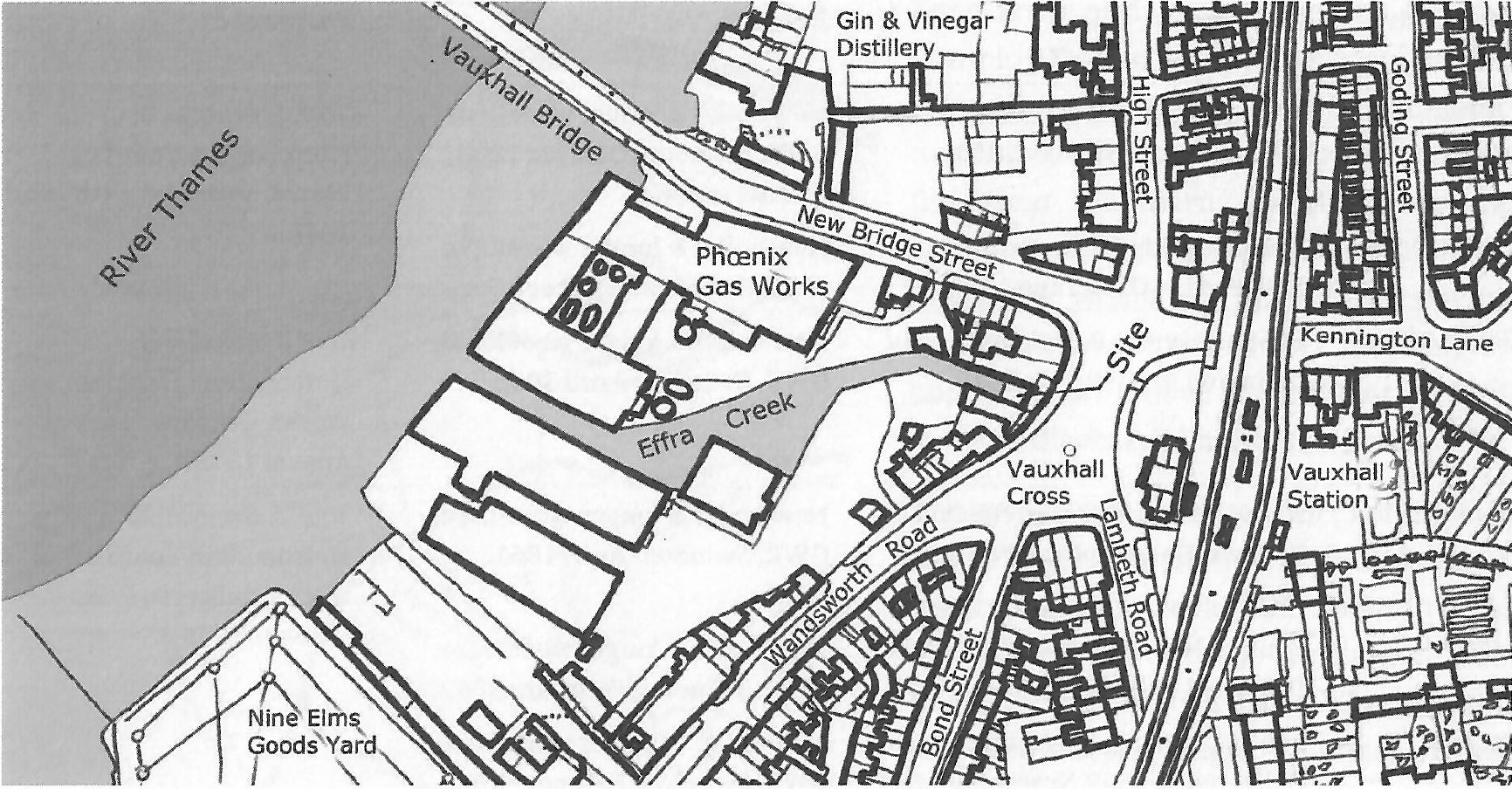
The Effra was progressively converted into covered culverts from 1848 and then became part of Bazalgette's London-wide sewage scheme. As from 1865, the river (now consisting of rainwater plus sewage) no longer discharged into the Thames but instead into the Southern Low Level Sewer - except when heavy rain required an overflow into Effra Creek and so into the Thames.
But the Effra and surrounding lower-lying lands in Vauxhall were two metres or more below the level of high tides in the Thames. This meant that the overflows could only then be discharged on into the Thames at low tide. So heavy rain around the time of high tide meant that the effluent would often instead flood local properties, some of which had basements. Here is an 1877 press report. (Click on it to bring up a larger version.)

This problem was addressed rather ingeniously in 1879 when the Metropolitan Board of Works bought a redundant broad gauge railway engine, Saturn, from the Great Western Railway. Saturn was repurposed as a pumping engine and set up at the end of Effra Creek in a new shed erected in the yard behind the Sluice Keeper's cottage which in turn fronted onto Vauxhall Cross. It was then used, when necessary, to pump effluent up out of the Effra and over into the Thames.
These two maps show the Creek 'before and after'. They are taken from 1869/71 and 1893/4 Ordnance Survey maps respectively. Note how Vauxhall Station has gained both platforms and running lines over the intervening period.

Why 'Effra'?
The Effra existed for centuries without a distinct name, although the lower reaches came to be known as Vauxhall Creek and another stretches were known as The Washway and South Lambeth Ditch. Its eventual naming was almost accidental when a short stretch which ran through Effra Farm, Brixton was referred to, in 1831, as Effra Sewer by the Sewer Commissioners. The name then became attached to the whole watercourse.
Effra Farm was probably a corruption of 'Heathrow' as the farm was originally part of the old Manor of Heathrow.
Further Detail
I strongly recommend Jon Newman's River Effra: South London's secret spine as the most detailed and well-researched guide to the Effra. But Tom Bolton's London's Lost Rivers: A Walker's Guide is also very good, and covers many other rivers as well, although it was written before it was realised that the Effra originally ran into Lambeth Marsh. Graham Gibbard's On Lambeth Marsh is a very detailed history of what is now the South Bank and Waterloo. Nicholas Barton's The Lost Rivers of London and Paul Talling's London's Lost Rivers are also good reads, with much better photos than the previously mentioned guides.
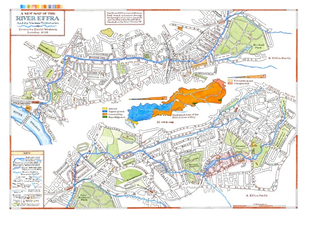
David Western has drawn this beautiful map of the Effra and its surroundings. A1 and A2 sized limited edition prints (£105 and £55) are available direct from David either via e mail or by phone: 020 7642 3271 or 07812 745 004.
On the web, I enjoyed geographer Martin Knight's interesting article about the ways in which the River Effra helped to shape local patterns of land use, transport and settlement. And another of Martin Knight's articles is equally interesting, not least for the photos. London Geezer has written an entertaining blog about the Effra, and a fascinating history of the frequently-flooded and cholera-ridden Lambeth waterside is here. But at least Dr John Snow was eventually able to use Lambeth in his Grand Experiment to prove that Cholera was water- (not air-) borne.
A two-part history of the Nunhead to Crystal Palace railway is here.
A general history of Lambeth, Vauxhall and Kennington and a guide to the availability of old maps of London can be accessed via this site's home page. Note in particular the availability of a wide range of old Ordnance Survey maps from Alan Godfrey Maps.