Introduction
This page will help you to look at a sample of maps of Vauxhall and Kennington from 1610 to the present day. The maps are listed in date order, oldest first.
Most of the images below are thumbnails. Please click on them to bring up larger images.
Other Sources
There are lots of London maps, dating back to the 1500s. One extensive list is here. Here are some other sources of old maps:-
- Stanfords
- Alan Godfrey who reproduce very detailed (1:4340) Ordnance Survey maps from the 1870s to the 1910s
- The London Topographical Society
- The David Rumsey Map Collection
- Layers of London
The Maps
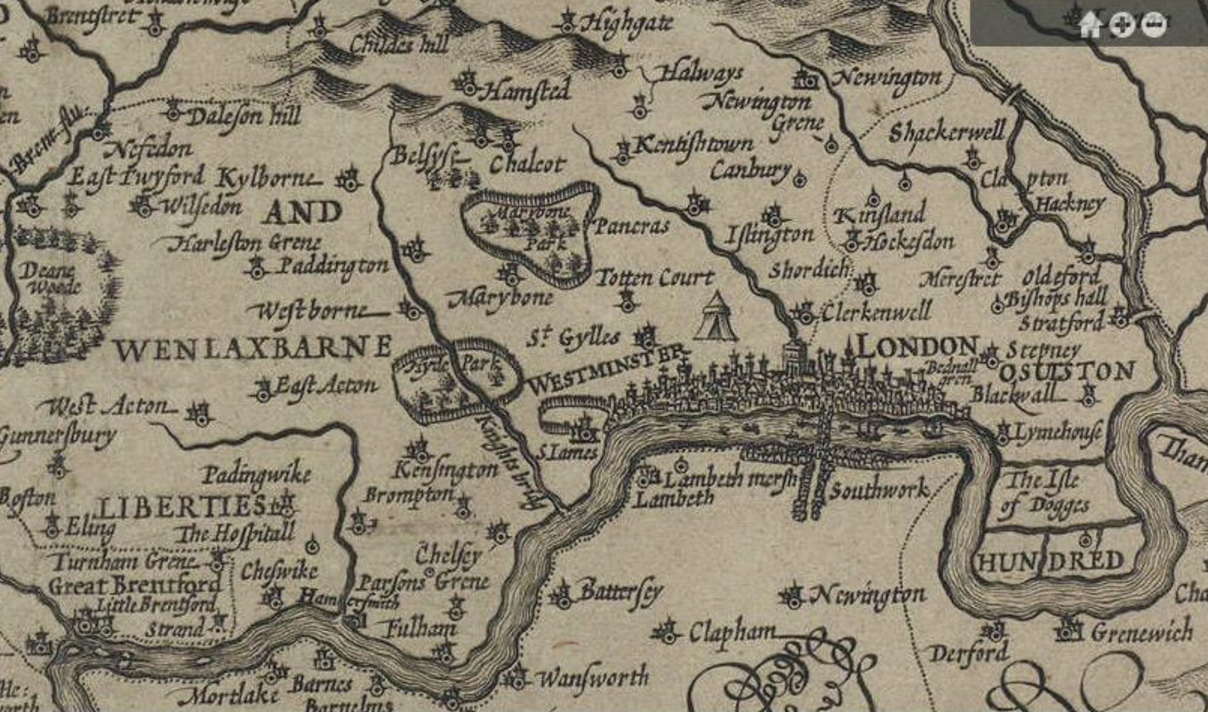
1610 John Norden's Map showing the fenced Royal hunting grounds
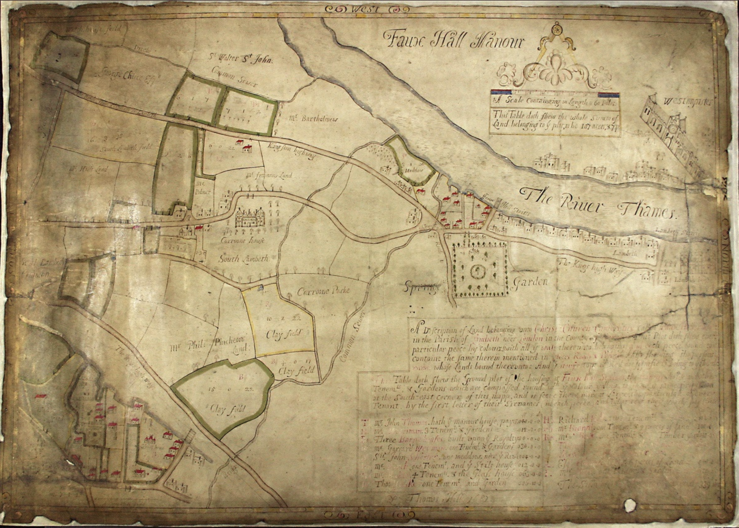
1681 Vauxhall Manor
This plan was prepared for Canterbury Cathedral. The manor had been granted to the Cathedral in 1362 by Edward of Woodstock, the Black Prince. Note that West at the top.
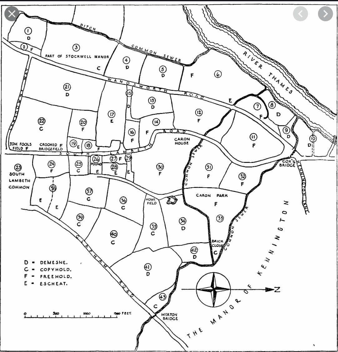
1681 Map of Vauxhall Manor
This plan is clearly closely related to the one above. Note that West is at the top of the map.
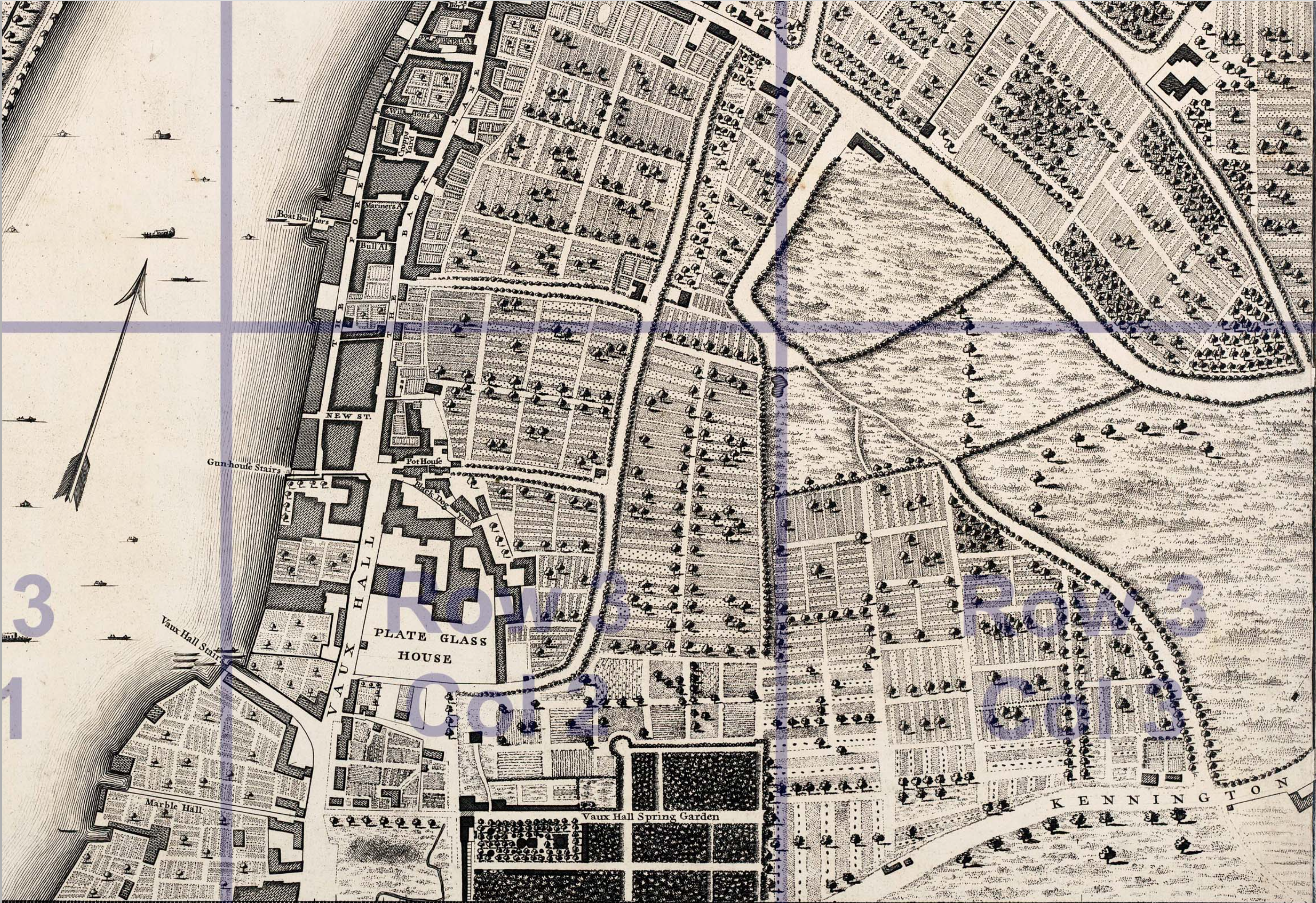
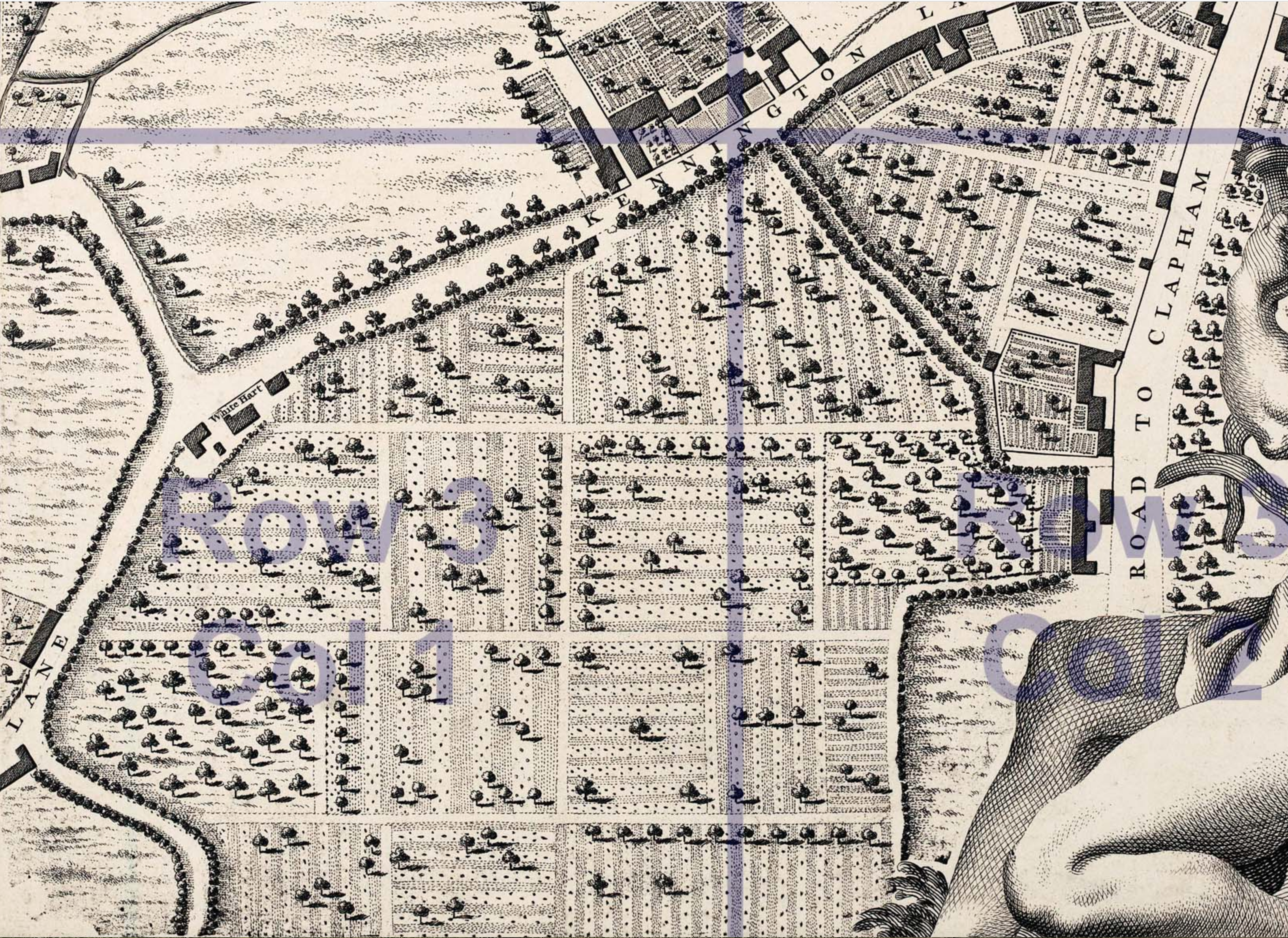
John Rocque's 1746 Map of London
This is a very detailed map (1:2,437) of London. Copies are available from Stanfords.
Here is some detail:
And here is a wonderful colourised version prepared by Londonist's Matt Brown:

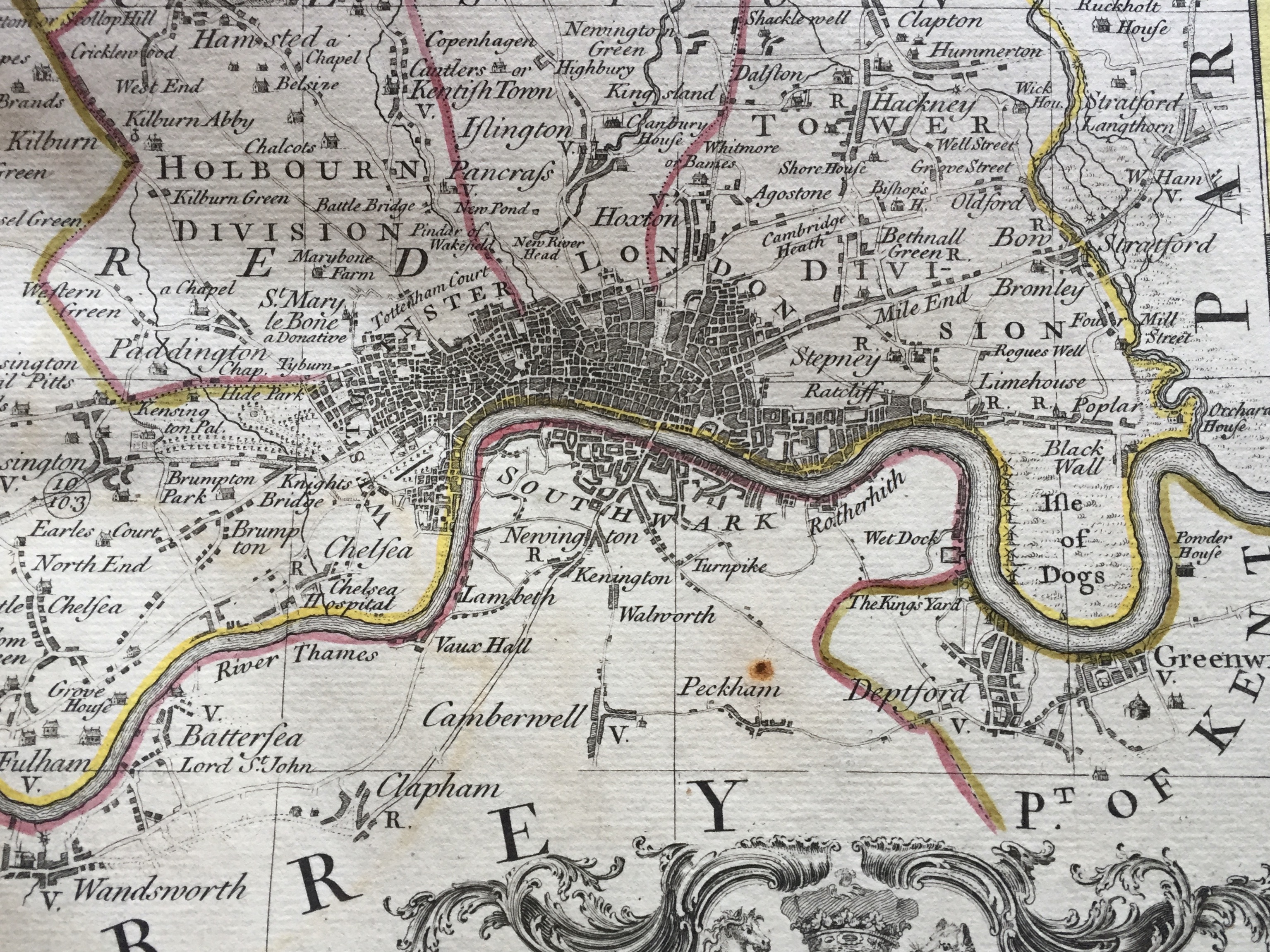
Bowen/Kitchin Large English Atlas 1755
This is the Middlesex page of this atlas. The Surrey side is therefore not so detailed . Note that 'Newington' looks very much like 'Nennington' but that was because of the typography of the time.
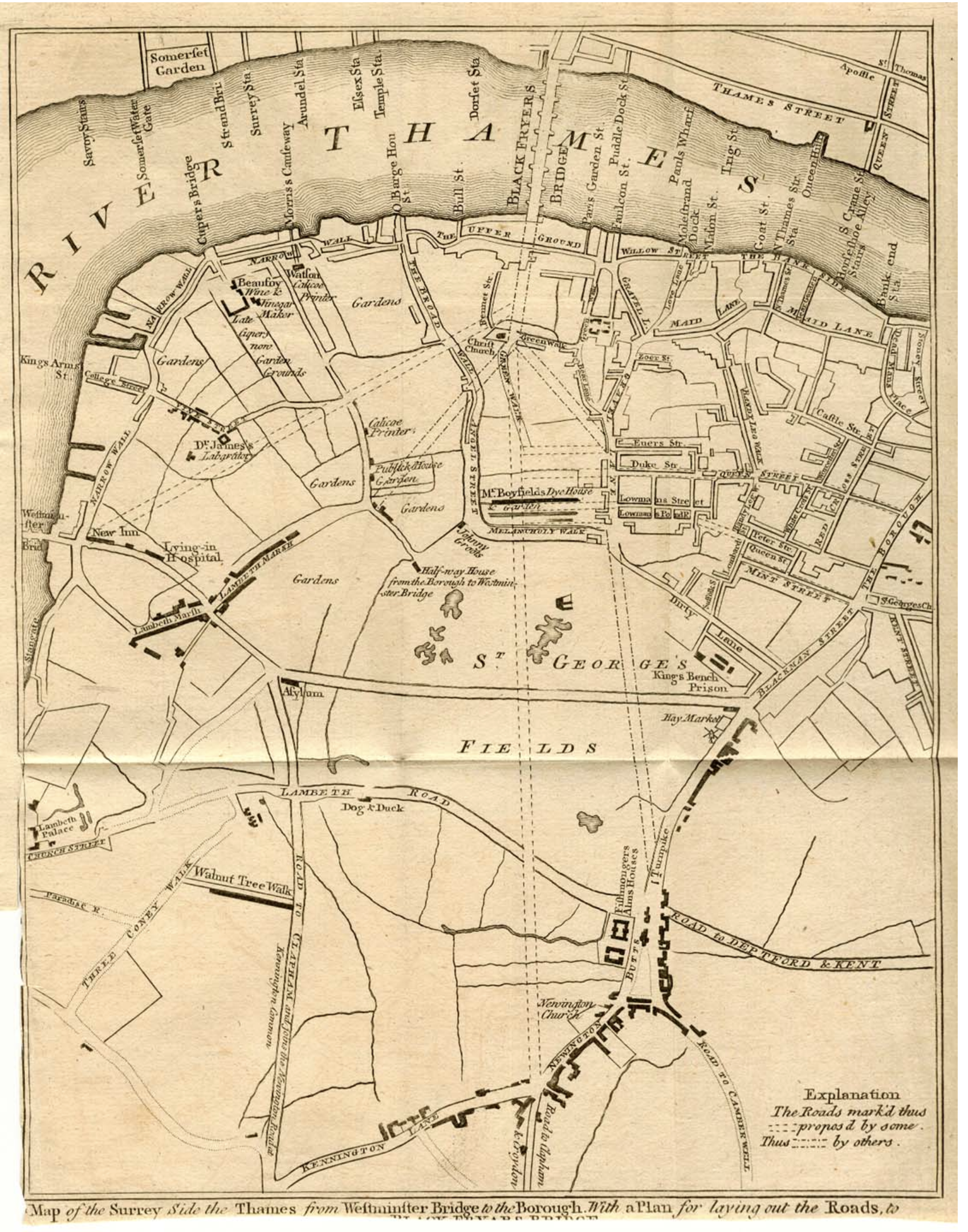
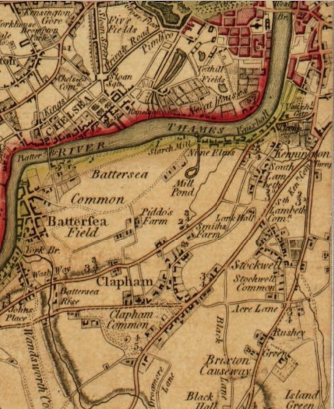
Surrey side of the Thames in 1766
This map was originally published in "Gentleman's Magazine"
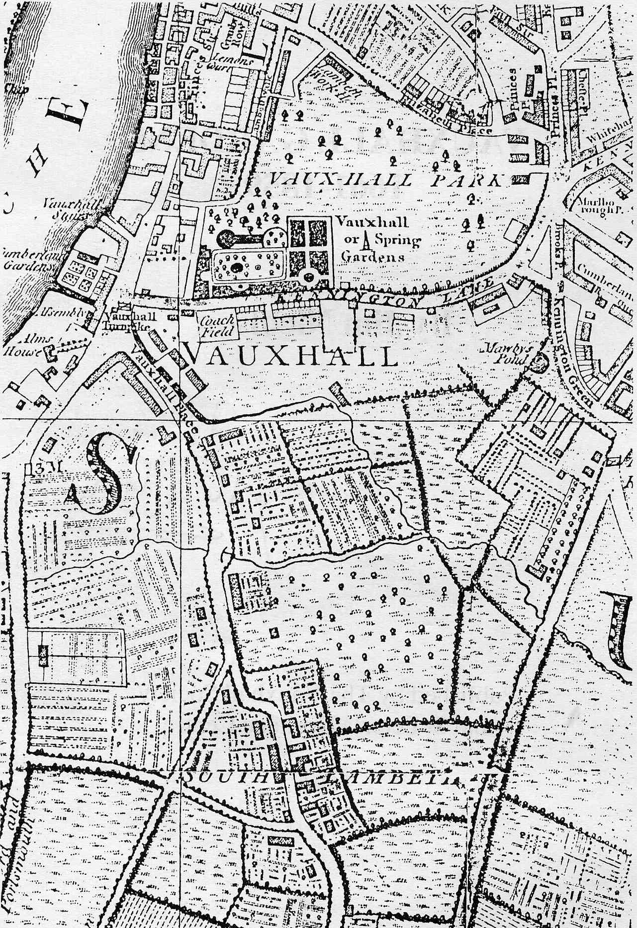
Vauxhall and South Lambeth in 1790
This is an extract from W Faden's map of London and its suburbs.
Below is a more detailed map of Vauxhall and South Lambeth in 1790 inc. the Pleasure Gardens. Note that the area was still very rural.
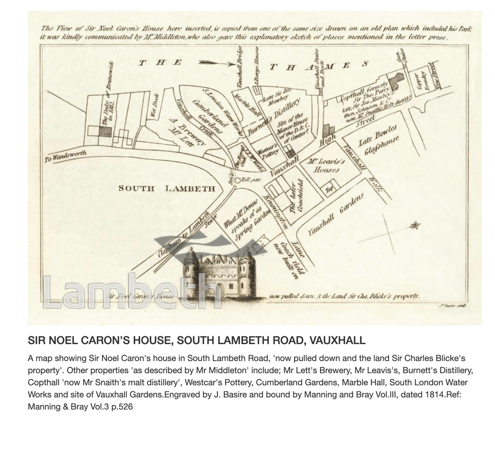
1800? - Noel Caron's House
This plan was presumably drawn around the end of the 1700s or in the early 1800s. Information about Noel Caron may be found here.
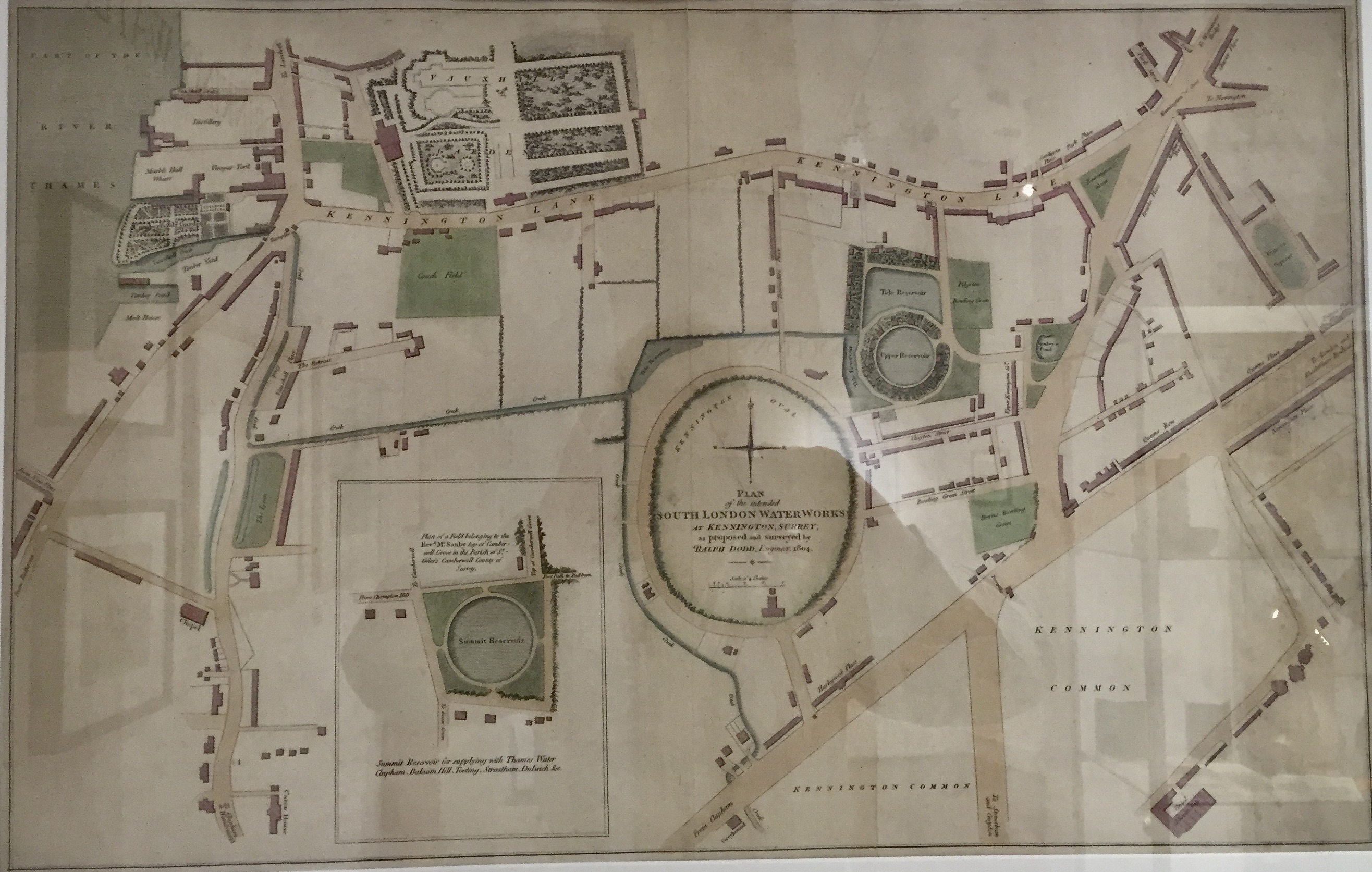
1804 - Proposed South London Waterworks
This shows the proposed site of two reservoirs next to gardens that became the Oval Cricket Ground.
Strangers Guide to London 1807
This is a small part of this map which can be bought from the London Metropolitan Archives.
Part of a c.1811 Map of Surrey
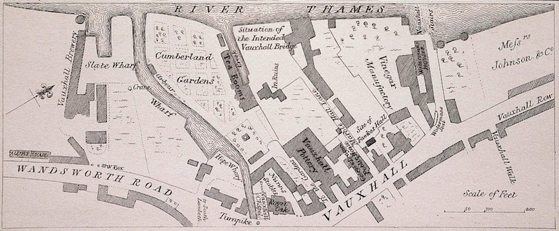
Vauxhall Riverside
Here is a plan of Vauxhall's riverside in the early 1800s. Note the Waterman's Houses and the Waterman's Seat (opposite the entrance to Vauxhall Walk) where the owners of the Thames Wherries waited for passengers.
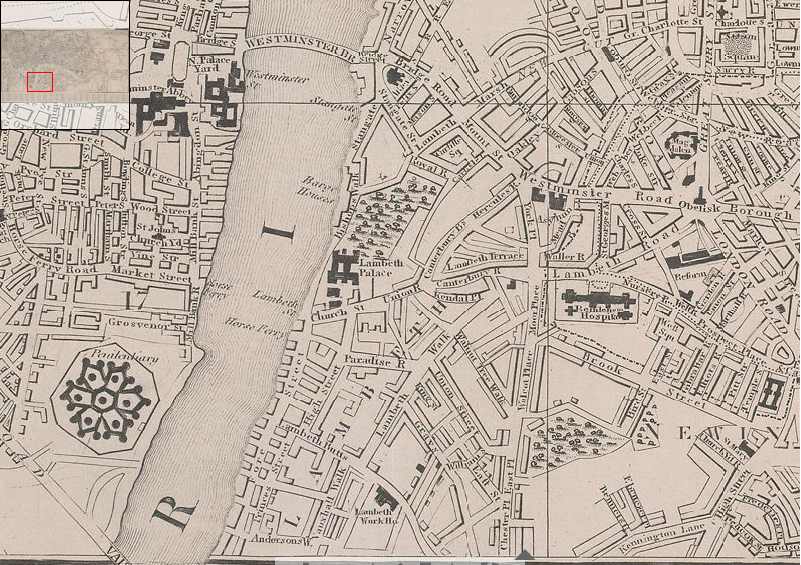
Cary's 1818 Map of London
Here is the Vauxhall area of this map, originally published at 1:9748.
The whole map is here.
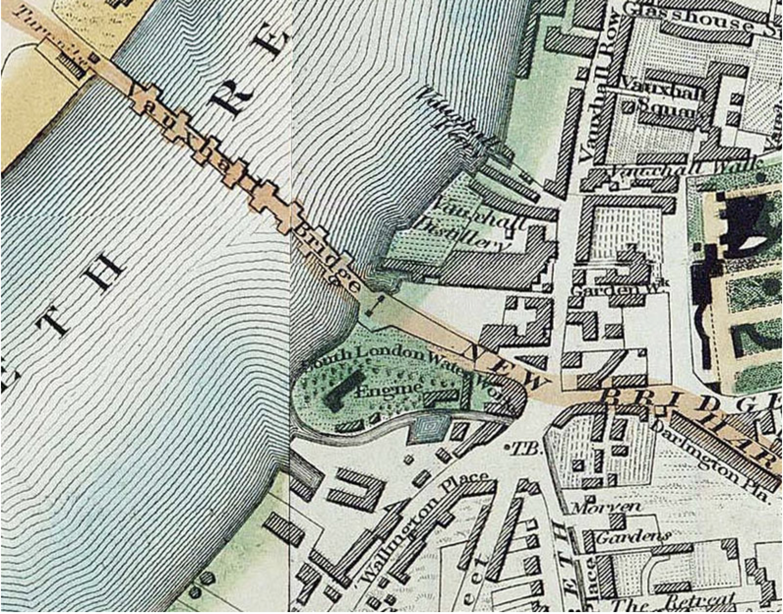
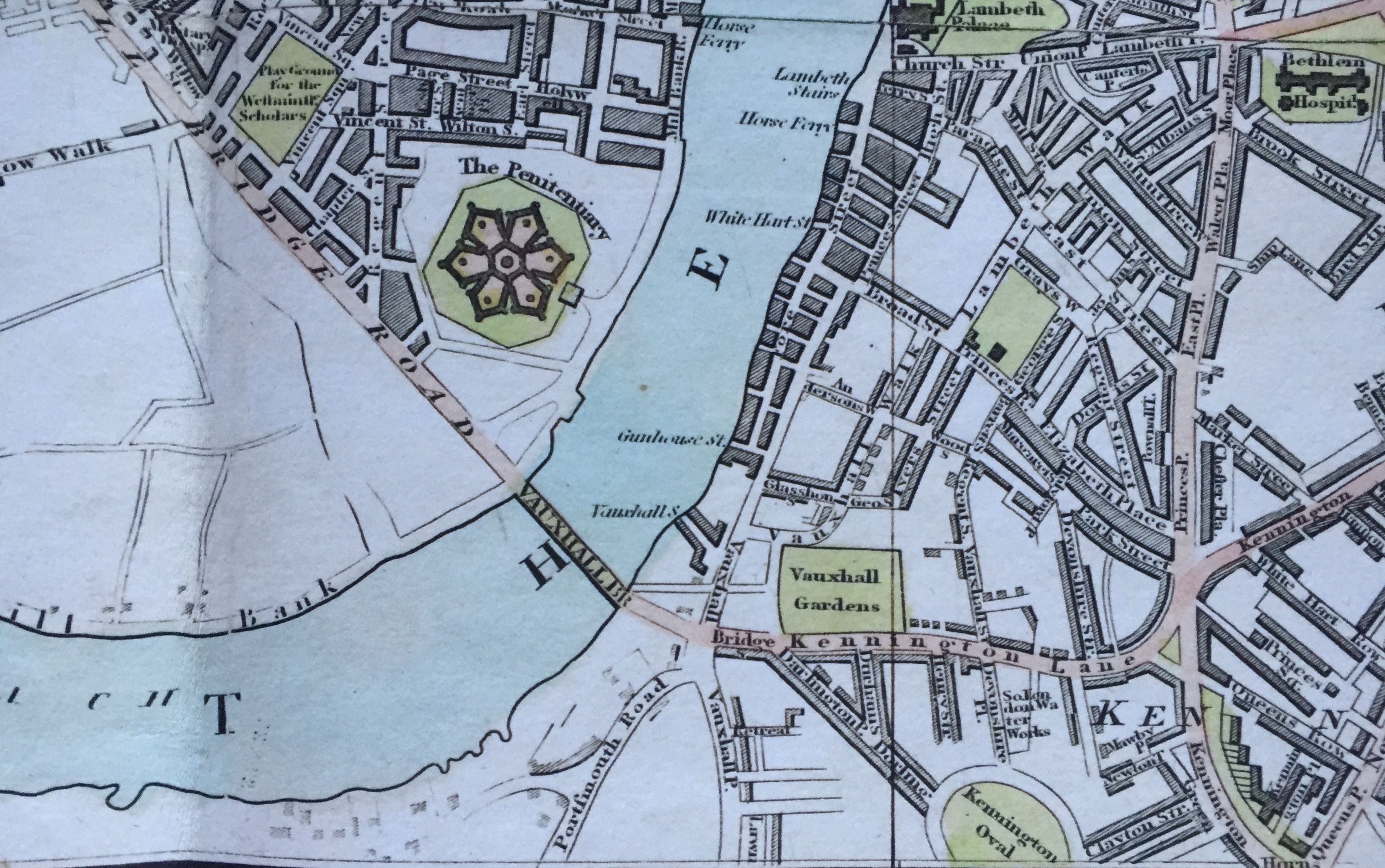
Greenwood's 1830 Map
This map shows the headquarters of the South London Waterworks between Vauxhall Bridge and the short creek which was originally where the diverted Effra reached the Thames.
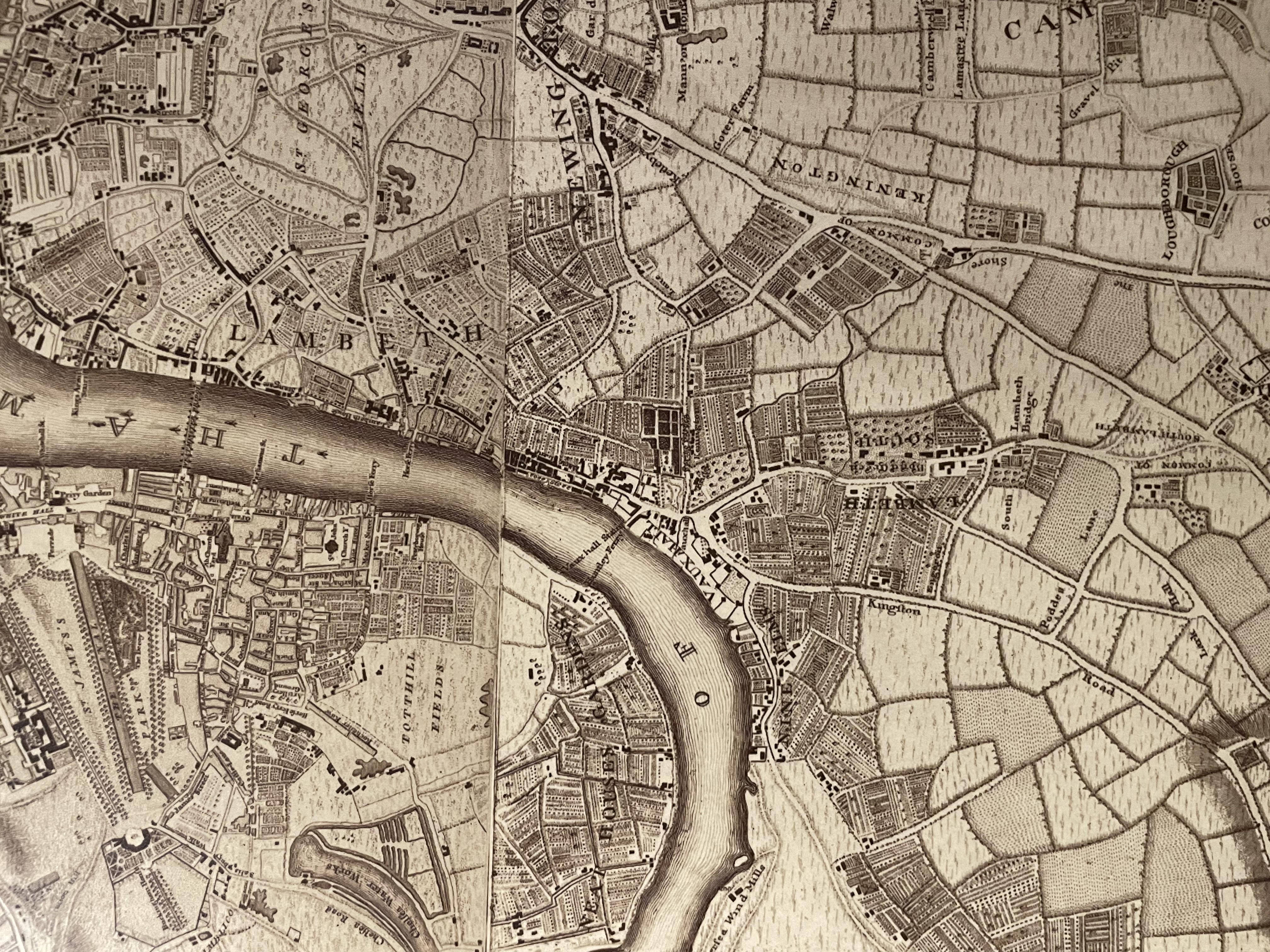
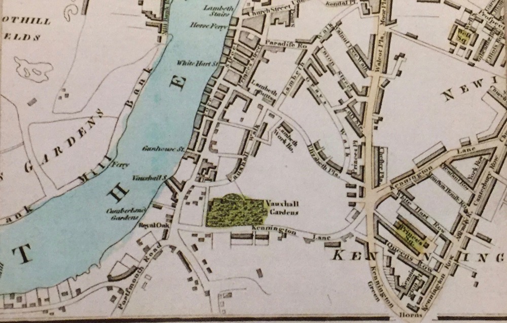
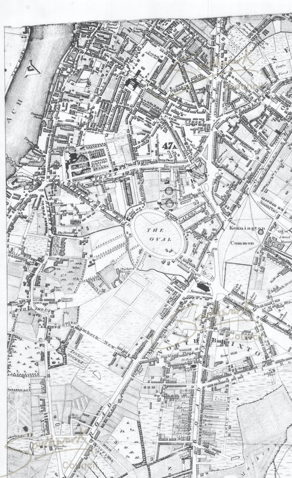
Kennington to Peckham c.1830
This is a reduced size extract from this map which covers a large part of South Central London.
Click on this image to bring up the whole map. Most browsers will then let you focus in on particular areas of the map. There may be + and - buttons in the bottom right hand corner, for instance.
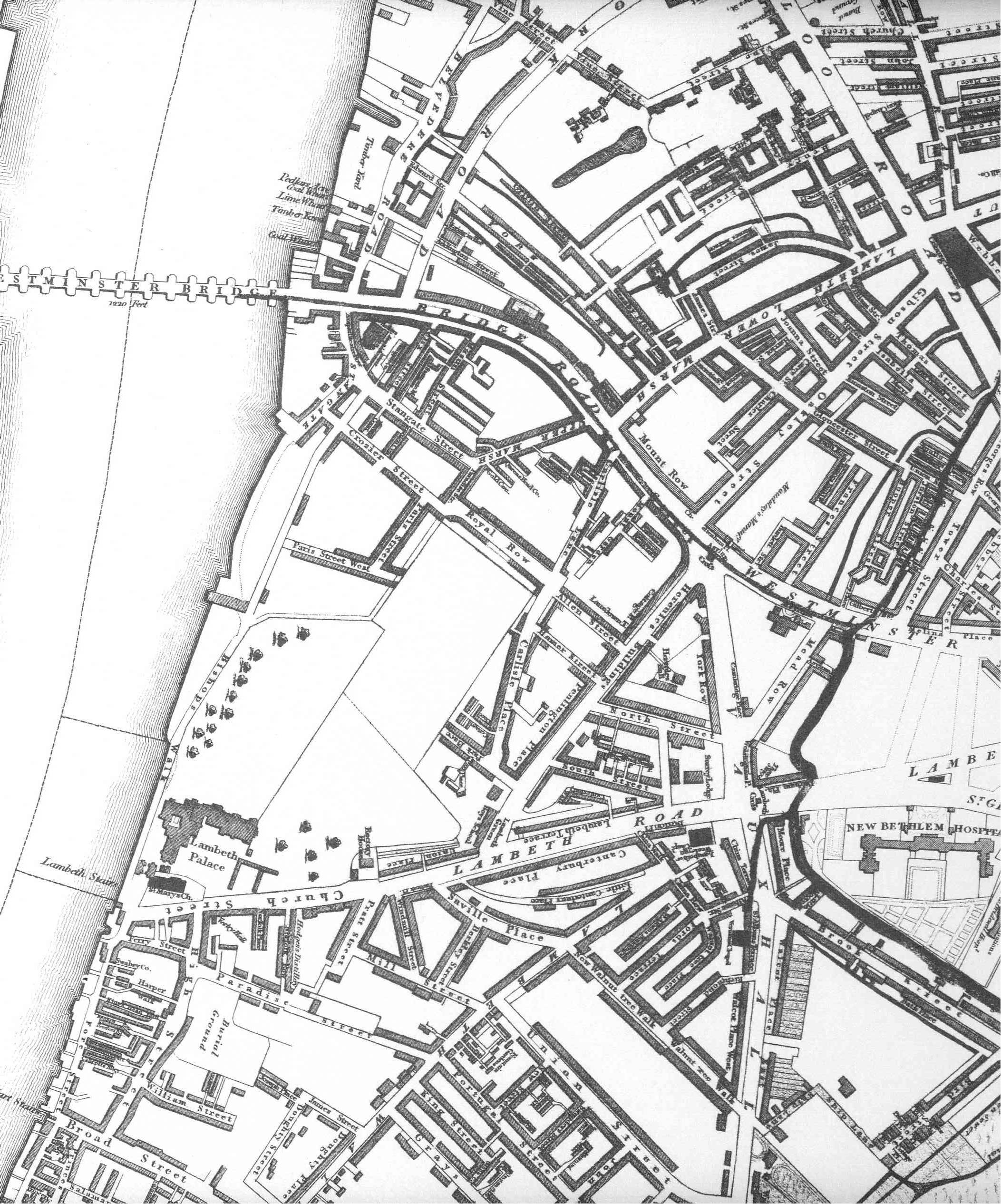
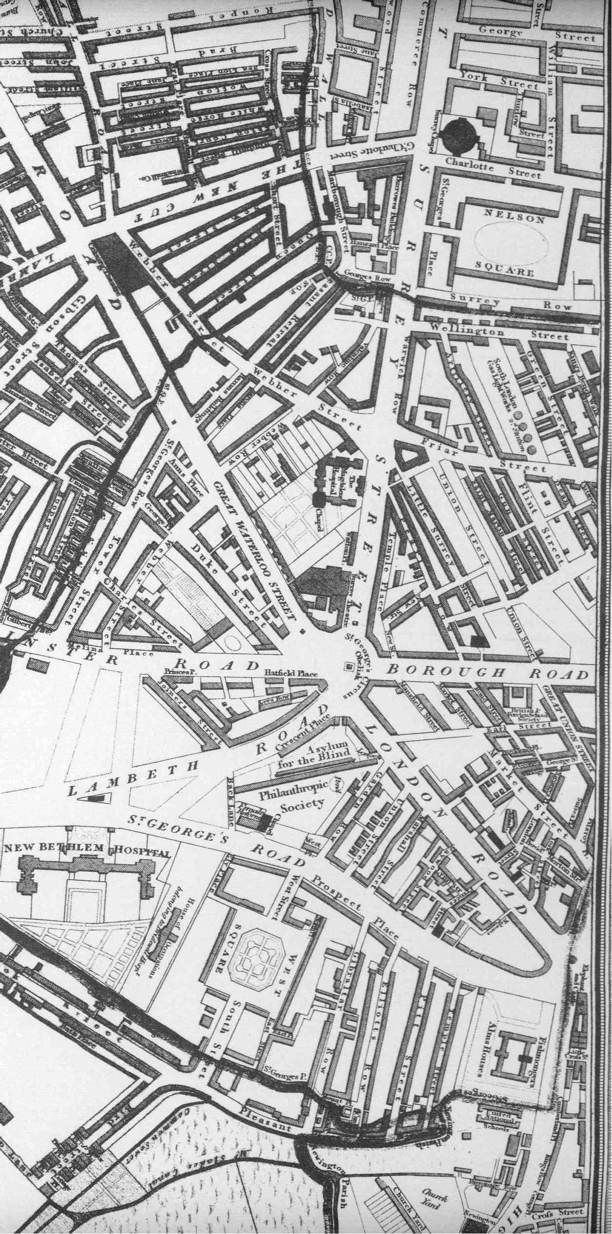
Williamson's 1831 Map of the Parish of Lambeth
Copies of this map can be obtained from Lambeth Archives. Here are thumbnails of four areas of this map.
1832 Anonymous 'New Map of London'
Mogg's 1837 Strangers Guide to London
A Street Map of London 1843
This map was published (at 3.25 inches to the mile) so that passengers in Hansom cabs could check that they were being taken by the shortest route.
The original can be bought in shops or from Old House Books.
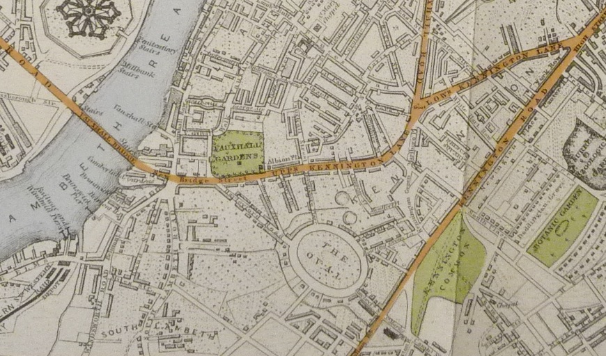
Cruchley's 1846 New Plan of London
This map was 'coloured to show the various routes of the omnibuses ... with all the railways and stations.
The full map can be seen here.
Here is an extract showing the area around Vauxhall Bridge.
1851 Tallis' Plan of London
This is the first map (on this website) to show the railway through Vauxhall Cross.
1851 Banks & Co Balloon View of London
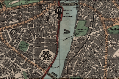
This view from Hampstead was published as a folding map in the year of the Great Exhibition. The Crystal Palace can be seen in Hyde Park. The Embankment is yet to be constructed, and Big Ben completed.
Dr John Snow's 1856 Map of Water Companies in South London
Click on this thumbnail to bring up this map which played a vital part in Dr Snow's Grand Experiment that proved that cholera is a water-borne disease.
1857-9 Reynold's Map of Modern London
This is R Jarman's re-drawing of Reynold's map originally published in 1857. Click on either thumbnail to be taken to the London-wide map.
1862 Stanford's Map of London
Click here to see this 1:10,560 map.
1863 John Wyld's Map
This shows some existing and proposed (but never built) railway lines.

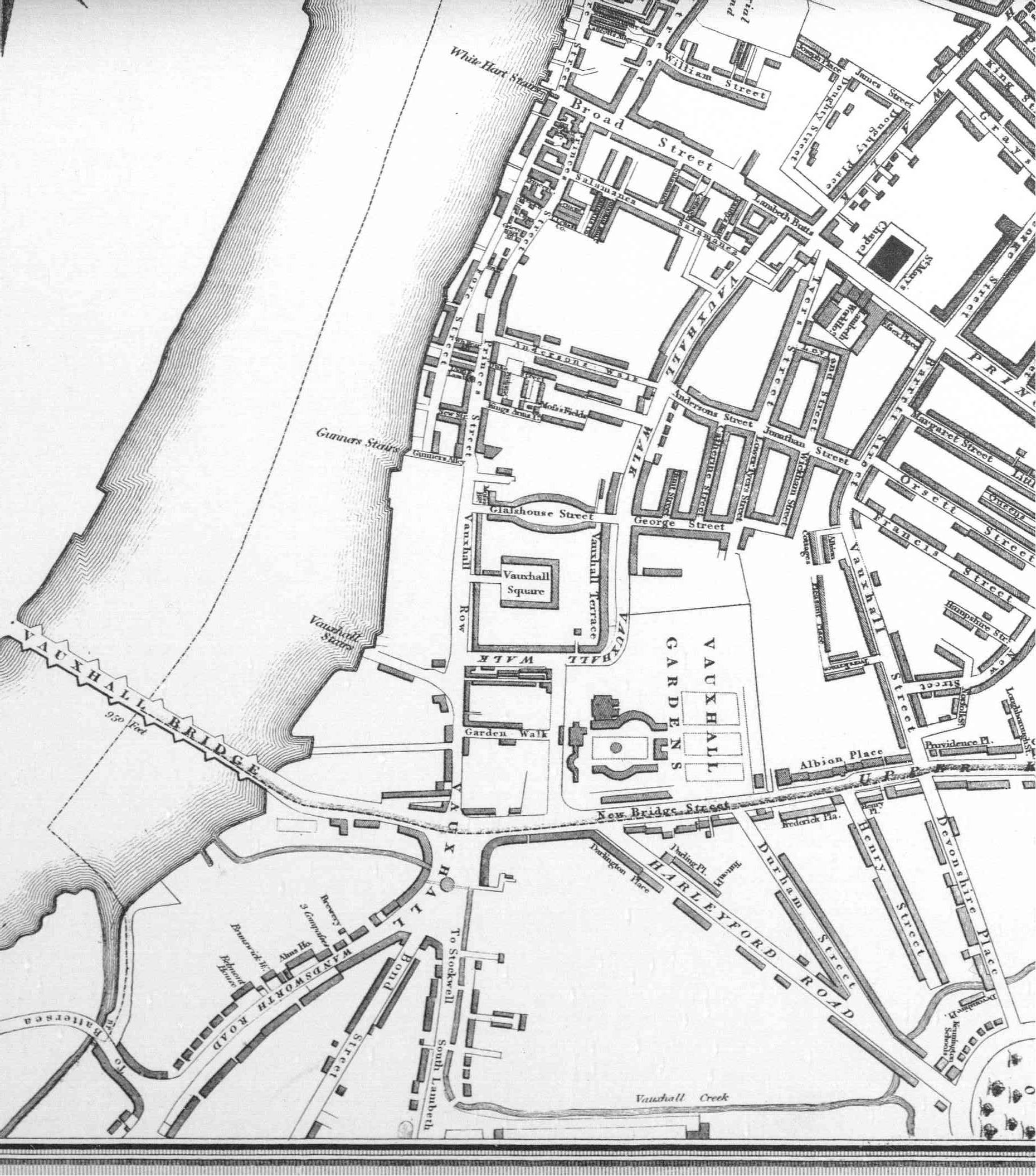
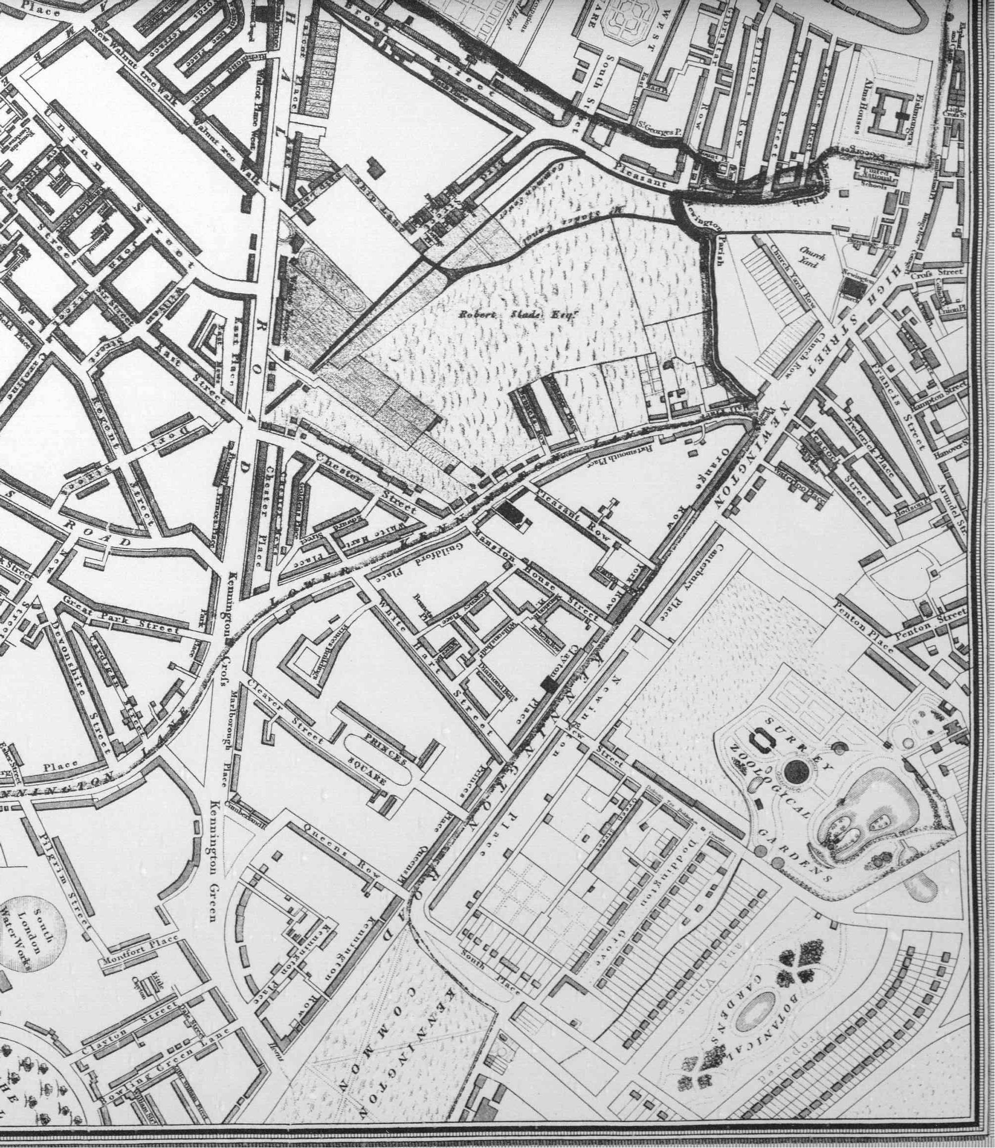
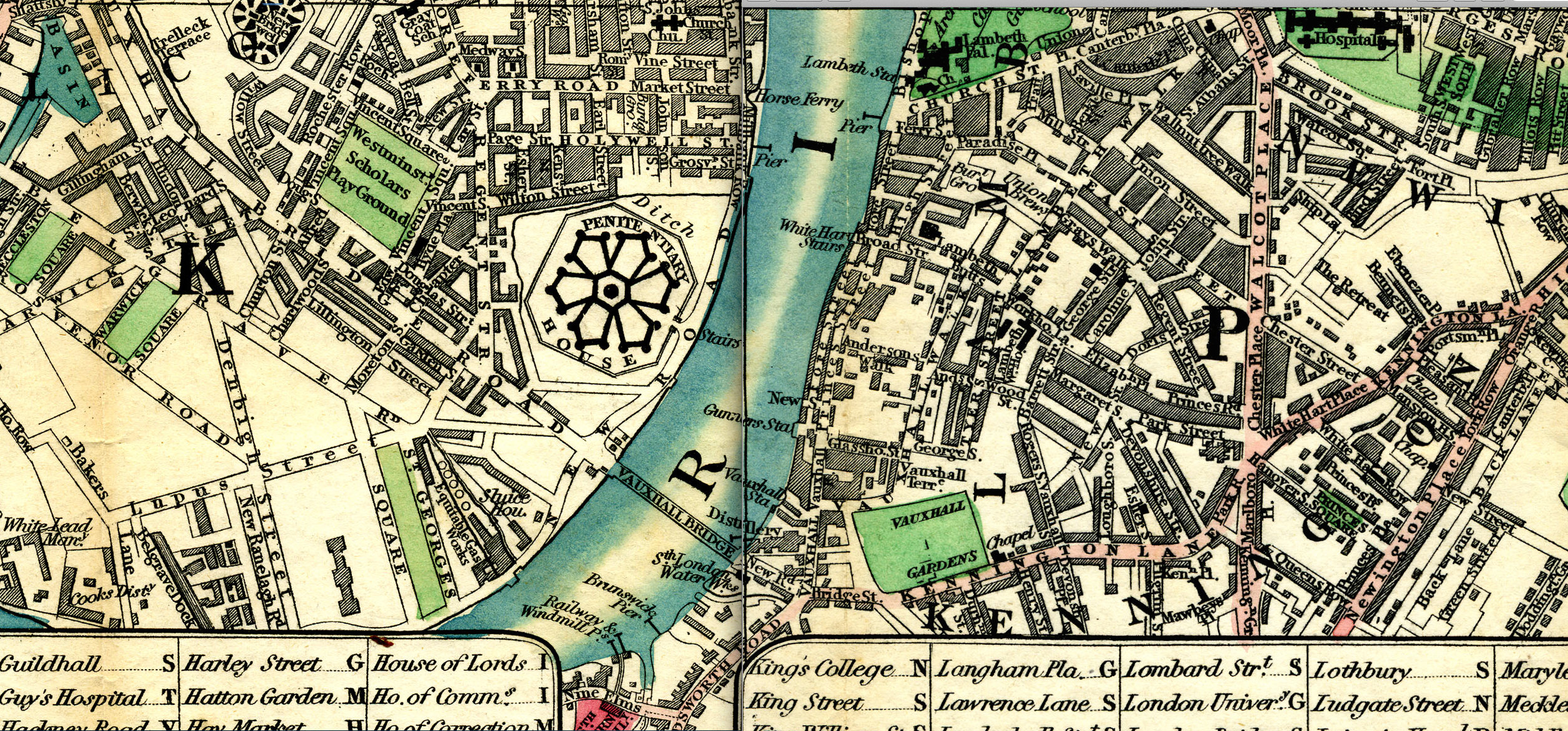
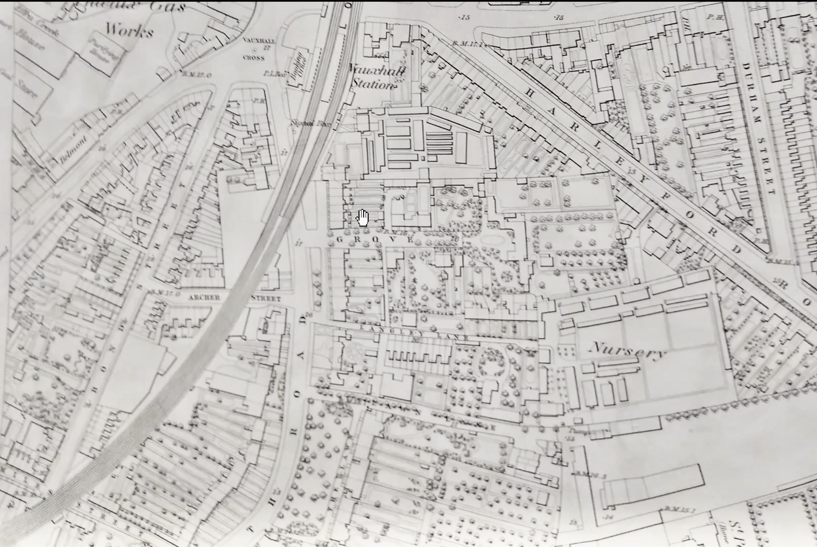
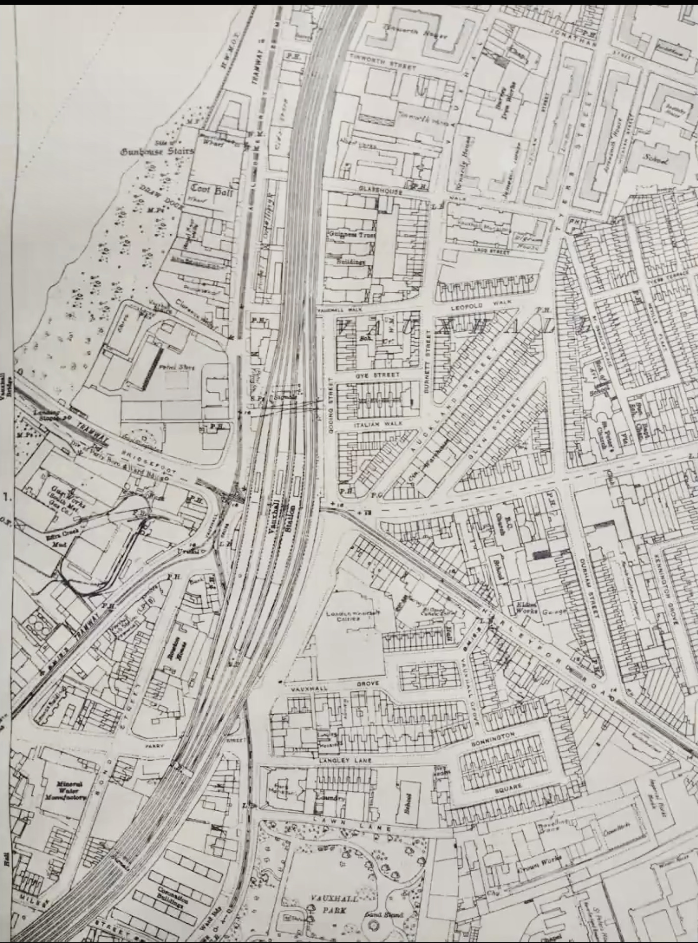
1870 and 1880 Ordnance Surveys
These extracts show how Vauxhall Cross developed over this 10 year period. The first two maps are the 1870 version, with a detailed extract to the right. The next two are 1880, again with a detailed extract to the right
.Note, for instance, how Bonnington Square was built over a nursery garden.
1877 - Stanford's 6 inches to the mile

1880 - Tithes
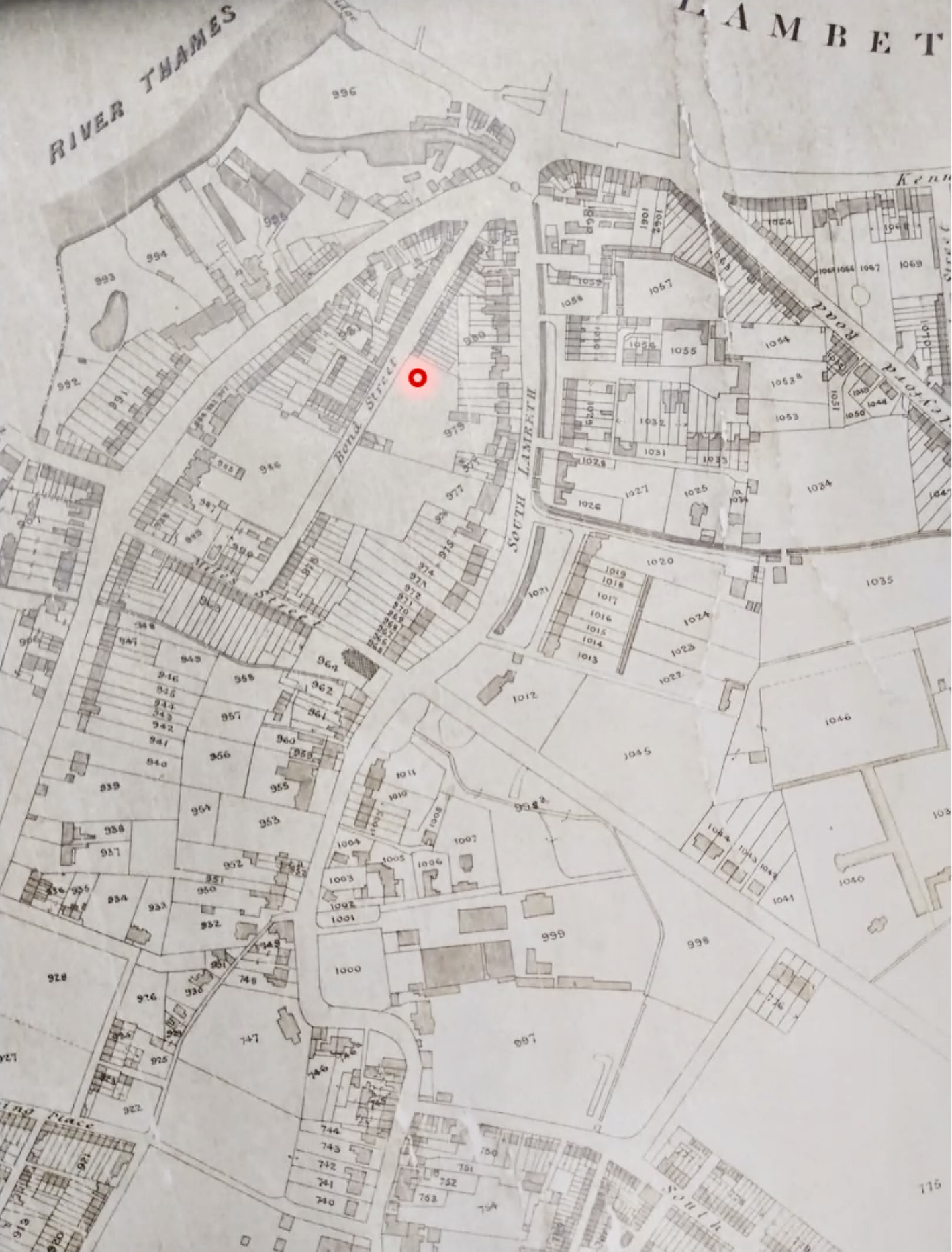
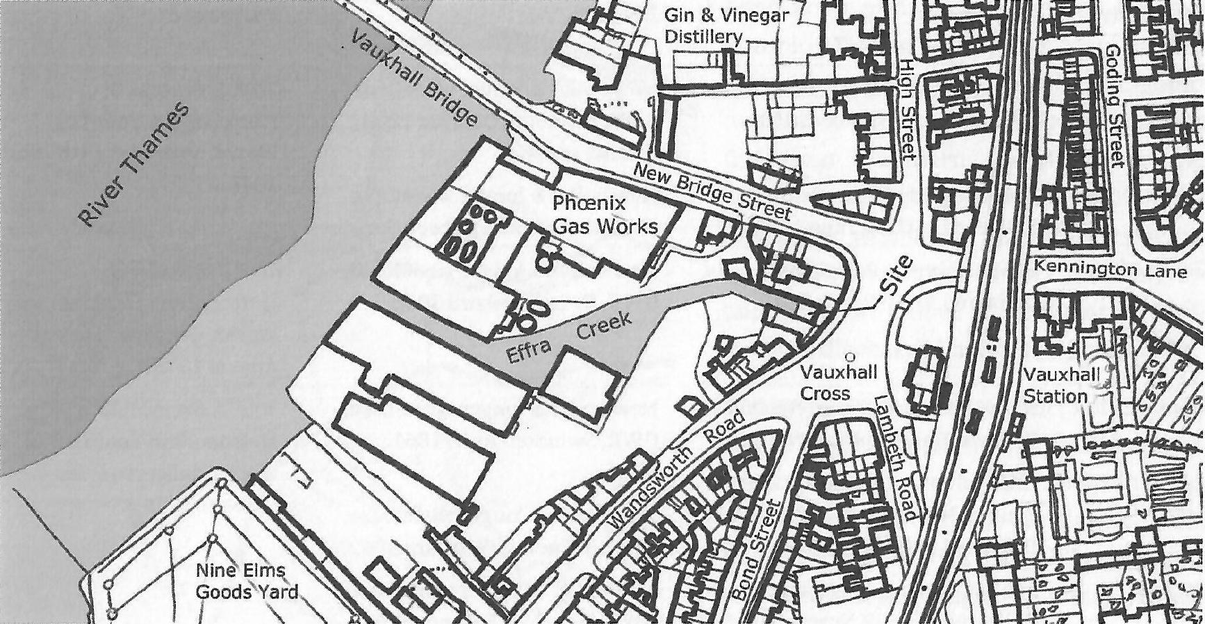
This is an extract from a map originally prepared to help organise the final payment of tithes. Note the course of the diverted River Effra, plus a smaller drainage ditch further south. The original is in the Lambeth Archives collection.
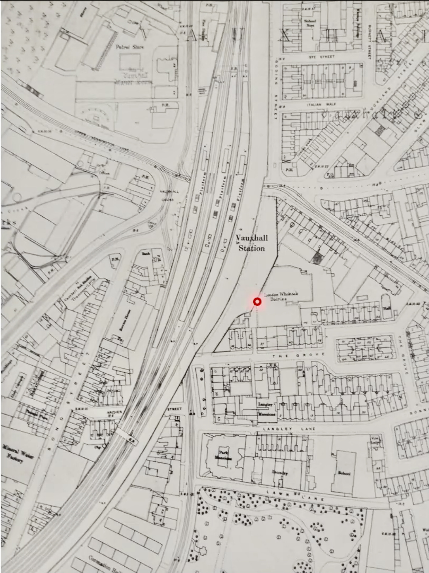
Here is another map (date unknown) showing Effra Creek and Vauxhall Station.
Bacon's 1888 Atlas of London
Click on one of the five links below to look at these very detailed (1:7,040) maps. Copies of pages of this atlas can be bought from the London Topographical Society.
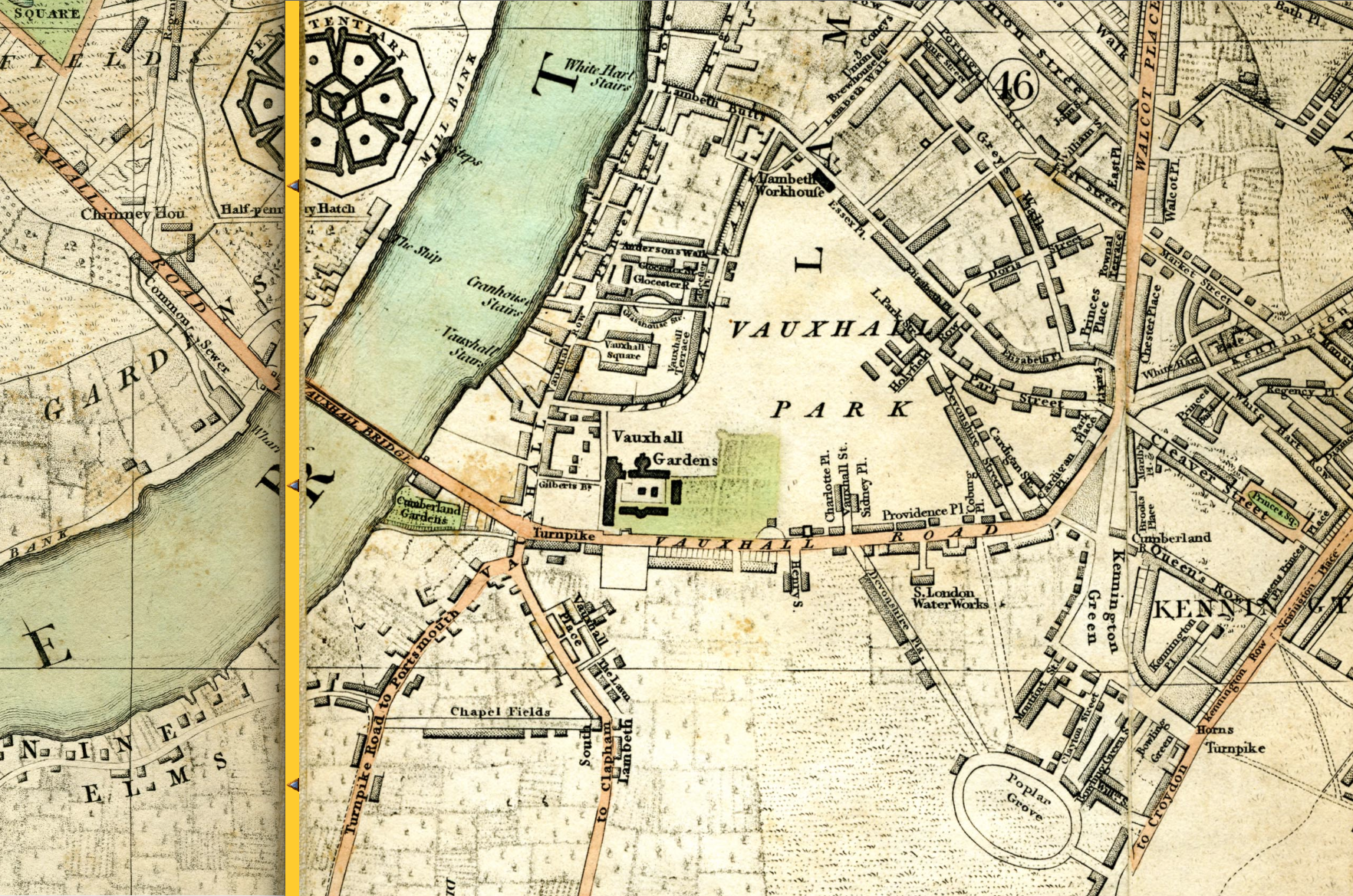
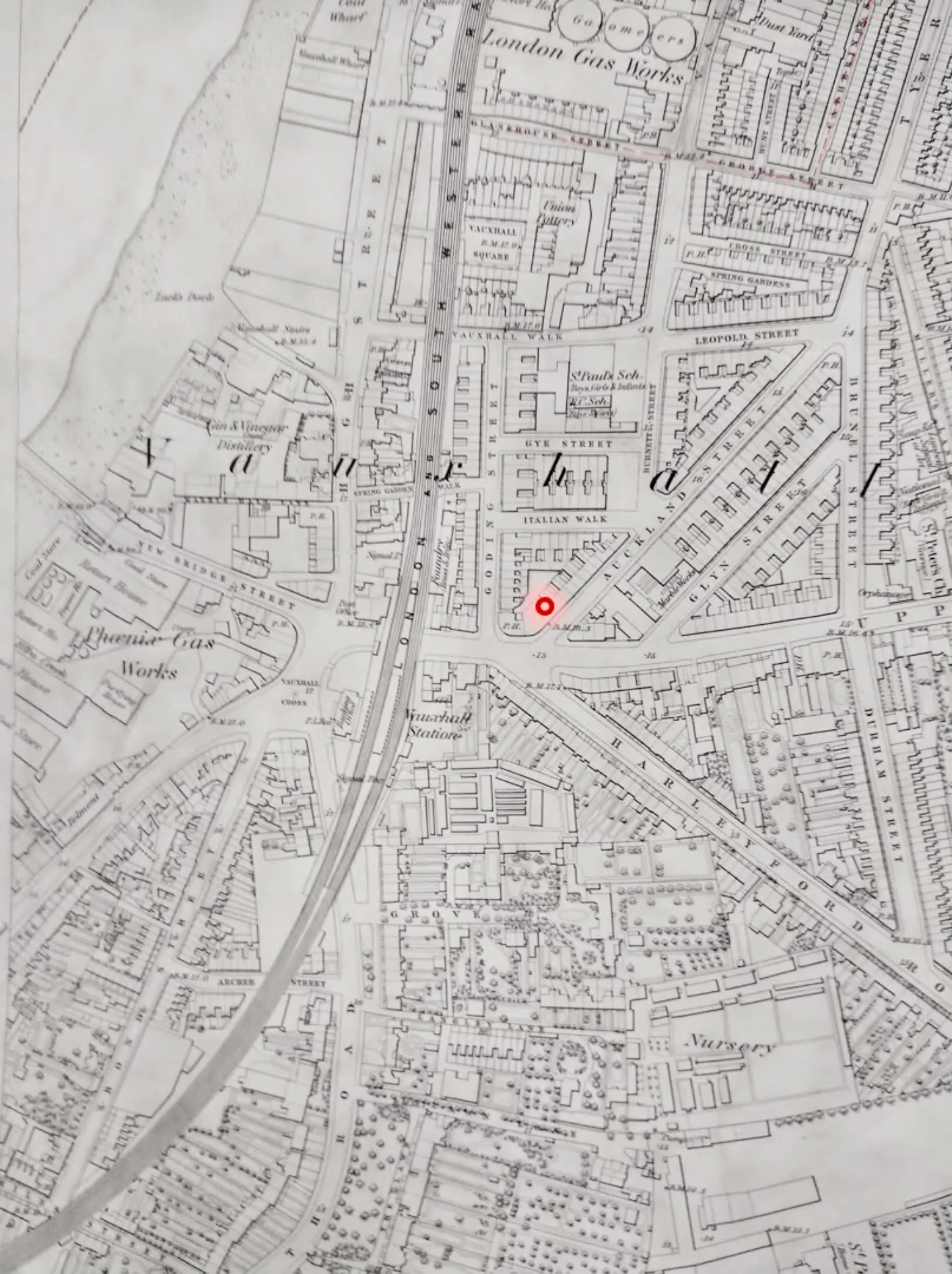
- Vauxhall Park & Spring Gardens - Note how the land had been built on following the closure of Vauxhall Pleasure Gardens.
- Kennington Cross
- Nine Elms
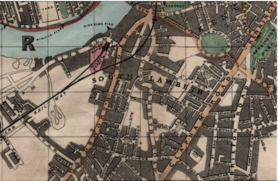
- Fentiman Road and Clapham Road - Note Oxford & Cambridge Terraces on Fentiman road, and that Richborne Terrace was still Richmond Terrace on one side and Osborne Terrace on the other.
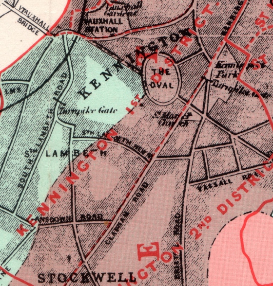
- The Oval and Kennington Park
The Charles Booth 1889 Descriptive Map of London Poverty
Click here to access this searchable London-wide street map and archive. Copies can be bought at the London Museum in the Barbican. It also features in Layers of London.

Bacon's 'Up to date' Map 1902
Note that Spring Gardens (the old Vauxhall Pleasure Gardens) have by now been built over.
The original can be bought in shops or from Old House Books.
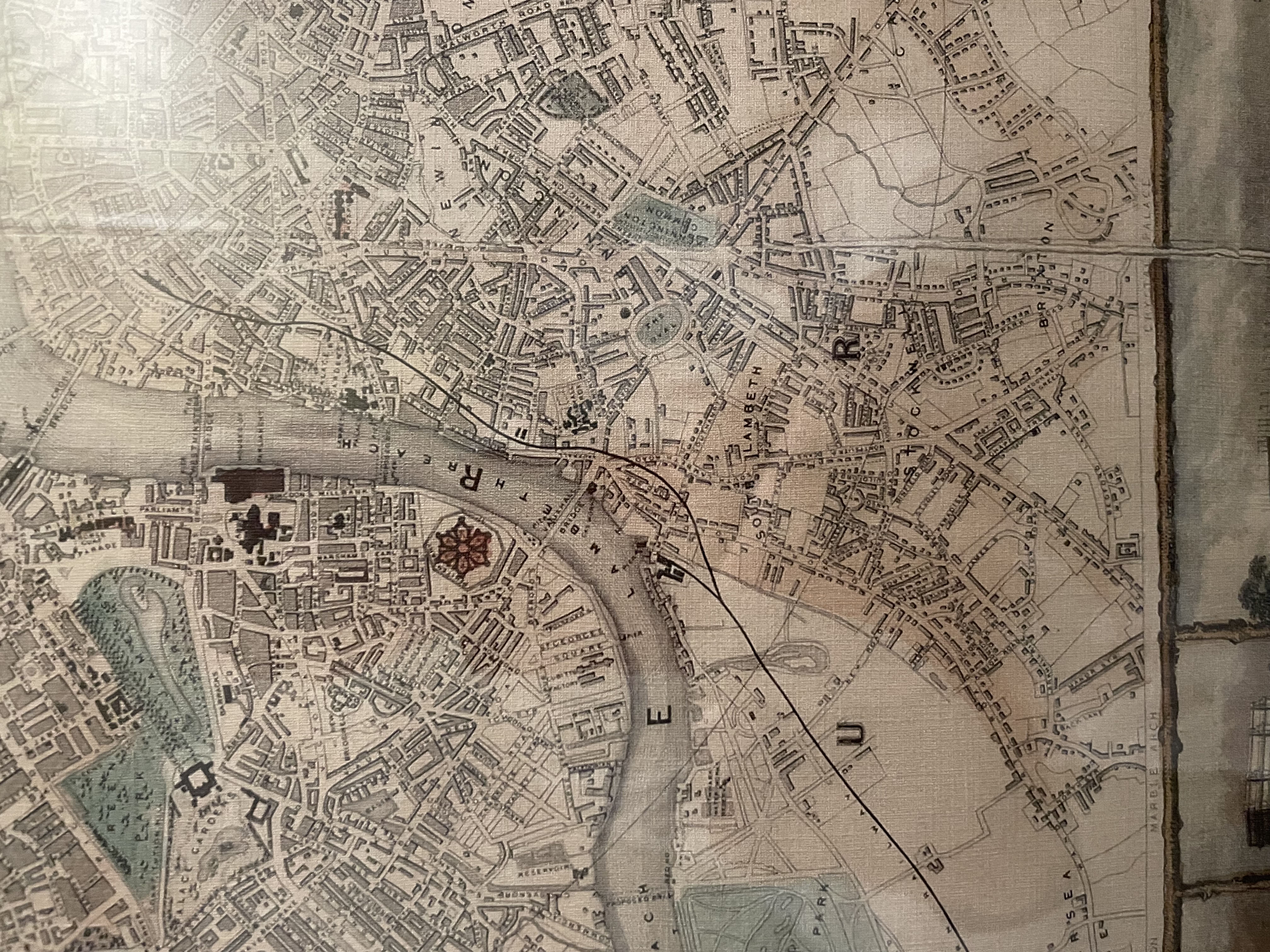
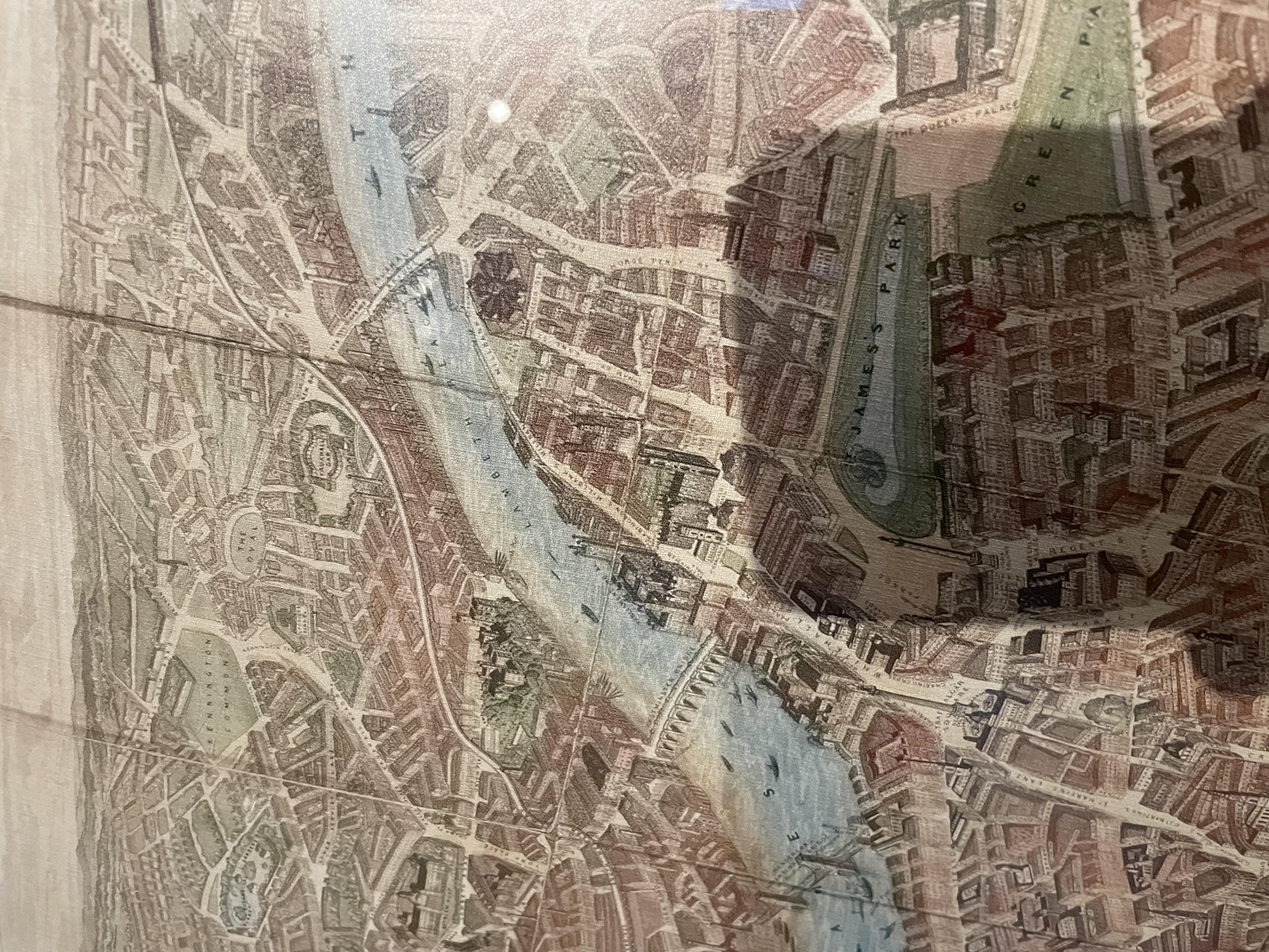
Early Ordnance Survey Maps 1871 - 1914
Alan Godfrey publishes these detailed and inexpensive maps, available from many booksellers as well as over the web.
London sheet 89 (Kennington & Walworth) is available for 3 dates: 1871, 1894 and 1914.
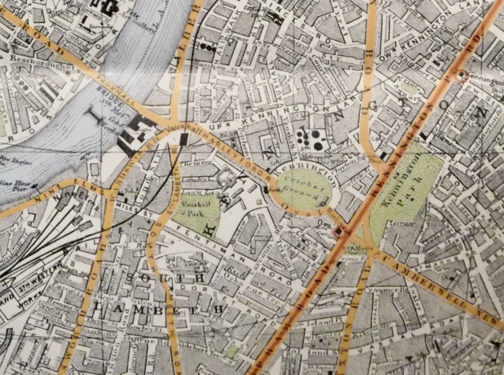
Other Ordnance Survey Maps
The National Library of Scotland have some lovely high resolution scans of 1:1056 OS maps of London between 1893 and 1896.
Railways and Trams
Maps showing local railway and tube lines, including the routes of the Victoria and Northern lines under Vauxhall and Kennington, may be found here.
And here is nice map of the tram lines around Vauxhall Cross.
Follow this link to see some lovely photos of old Vauxhall.